IMAGES TAKEN NEAR TO
Mitton Road, CLITHEROE, BB7 9JY
Introduction
This page details the photographs taken nearby to Mitton Road, BB7 9JY by members of the Geograph project.
The Geograph project started in 2005 with the aim of publishing, organising and preserving representative images for every square kilometre of Great Britain, Ireland and the Isle of Man.

There are currently over 7.5m images from over14,400 individuals and you can help contribute to the project by visiting https://www.geograph.org.uk
Image Map
Images are licensed for reuse under creativecommons.org/licenses/by-sa/2.0
Notes
- Clicking on the map will re-center to the selected point.
- The higher the marker number, the further away the image location is from the centre of the postcode.
Image Listing (26 Images Found)
Images are licensed for reuse under creativecommons.org/licenses/by-sa/2.0
Image
Details
Distance
1
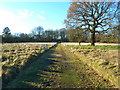
The bottom right hand corner
http://www.geograph.org.uk/photo/1807028
Image: © Alexander P Kapp
Taken: 14 Apr 2010
0.04 miles
2
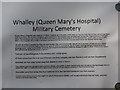
Newly erected sign at Whalley (Queen Mary's Hospital) Military Cemetery
This is a link to the bottom right hand corner of the sign. It gives you a short précis of the soldiers who died there. http://www.geograph.org.uk/photo/1807032
Image: © Alexander P Kapp
Taken: 14 Apr 2010
0.05 miles
3
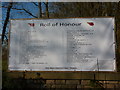
Entrance to Ribble Valley Remembrance Park
Image: © Alexander P Kapp
Taken: 20 Apr 2007
0.05 miles
4
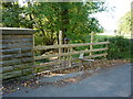
Stile, Mitton Road, Whalley
Provide an access point for new footpath on old railway.
Image: © Alexander P Kapp
Taken: 12 Oct 2010
0.05 miles
5
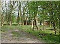
Ribble Valley Remembrance Park
At the far side of the Remembrance Park are the graves of 42 soldiers of which 33 died in WW1 and 9 in WW2. Some of the gravestones can be seen in between the two buildings. In the wooded area of the Park it is proposed that it will be a pet cemetery
Image: © Alexander P Kapp
Taken: 20 Apr 2007
0.05 miles
6
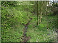
Disused railway
This railway was short line from the Blackburn Clitheroe Line and was used in the transport of wounded soldiers from France to Queen Mary's Military Hospital (later Calderstone Hospital) in the WW1
Image: © Alexander P Kapp
Taken: 20 Apr 2007
0.05 miles
7
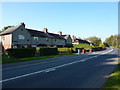
Bridge Terrace, Mitton Road, Whalley
Originally built for the staff of Calderstones Hospital
Image: © Alexander P Kapp
Taken: 12 Oct 2010
0.05 miles
8
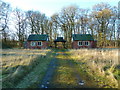
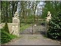
Lychgate and chapels, Calderstones Cemetery
Image: © Alexander P Kapp
Taken: 1 Dec 2012
0.06 miles
9
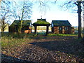
Lychgate and chapels, Calderstones Cemetery
A private cemetery, with the military cemetery, in the distance, through the Lychgate. Military personal were buried here during the First and Second World Wars, when Calderstones Hospital was a military hospital. It was here where some of the patients of Calderstones Hospital were buried when used as a mental hospital. It is not used any more and has been for sale on a number of occasions.
Image: © Alexander P Kapp
Taken: 1 Dec 2012
0.06 miles