
IMAGES TAKEN NEAR TO
Park Head, CLITHEROE, BB7 9FB
Introduction
This page details the photographs taken nearby to Park Head, BB7 9FB by members of the Geograph project.
The Geograph project started in 2005 with the aim of publishing, organising and preserving representative images for every square kilometre of Great Britain, Ireland and the Isle of Man.

There are currently over 7.5m images from over14,400 individuals and you can help contribute to the project by visiting https://www.geograph.org.uk
Image Map
Images are licensed for reuse under creativecommons.org/licenses/by-sa/2.0
Notes
- Clicking on the map will re-center to the selected point.
- The higher the marker number, the further away the image location is from the centre of the postcode.
Image Listing (14 Images Found)
Images are licensed for reuse under creativecommons.org/licenses/by-sa/2.0
Image
Details
Distance
1
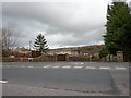
Parkhead
Road leads to a converted farm
Image: © Alexander P Kapp
Taken: 10 Mar 2011
0.02 miles
4
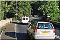
Devil's Elbow
This notorious accident blackspot on the A671 between Whalley and Read has recently been widened. It remains a notorious accident blackspot.
Image: © Mike and Kirsty Grundy
Taken: 22 Sep 2005
0.12 miles
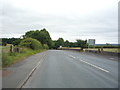
6
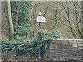
Village Signpost on the A671 Whalley Road on Read New Bridge
Located on the southwest side of the A671 Whalley Road on Read New Bridge in Read parish.
Milestone Society National ID: LA_SD7434W
Image: © D Phillips
Taken: 1 Mar 2023
0.19 miles
7
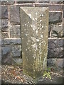
Old Boundary Marker by the A671, Whalley Road, Park Head Bridge
Parish Boundary Marker by the A671, in parish of Whalley (Ribble Valley District), Read New Bridge, Whalley Road, North side of road.
Inscription reads vertically:-
: WHALLEY : : READ :
Surveyed
Milestone Society National ID: LA_BUCL06pb
Image: © J Armstrong
Taken: 1 Oct 2012
0.19 miles
8
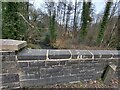
Old Bridge Marker on the A671 Whalley Road
Bridge Marker set in the parapet of Read New Bridge, Sabden Brook, next to boundary marker LA_BUCL06pb, on the north side of the A671 Whalley Road. On the boundary of Whalley and Read parishes.
Milestone Society National ID: LA_WHAREA01br
Image: © D Phillips
Taken: 1 Mar 2023
0.19 miles
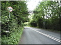
10
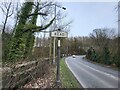
Village Signpost on the A671 Whalley Road near Read New Bridge
Located on the northeast side of the A671 Whalley Road at the east end of Read New Bridge in Read parish.
Milestone Society National ID: LA_SD7434V
Image: © D Phillips
Taken: 1 Mar 2023
0.19 miles