IMAGES TAKEN NEAR TO
Clerk Hill Road, CLITHEROE, BB7 9DR
Introduction
This page details the photographs taken nearby to Clerk Hill Road, BB7 9DR by members of the Geograph project.
The Geograph project started in 2005 with the aim of publishing, organising and preserving representative images for every square kilometre of Great Britain, Ireland and the Isle of Man.

There are currently over 7.5m images from over14,400 individuals and you can help contribute to the project by visiting https://www.geograph.org.uk
Image Map
Images are licensed for reuse under creativecommons.org/licenses/by-sa/2.0
Notes
- Clicking on the map will re-center to the selected point.
- The higher the marker number, the further away the image location is from the centre of the postcode.
Image Listing (11 Images Found)
Images are licensed for reuse under creativecommons.org/licenses/by-sa/2.0
Image
Details
Distance
2
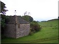
Fancy weathervane at Clerk Hill
Public footpath passes near this stone building
Image: © Raymond Knapman
Taken: 13 Jun 2011
0.05 miles
4
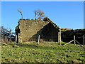
Ruined Barn near Clerk Hill
Slow process of total collapse of this unwanted and unloved building - trees sprouting out of its very walls.
Image: © Chris Heaton
Taken: 20 Jan 2014
0.14 miles
5
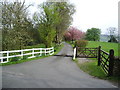
Entrance and road to Lower Clerk Hill
Image: © Alexander P Kapp
Taken: 20 Apr 2007
0.16 miles

8
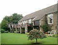
Whalley Golf Club
The Clubhouse - Long Leese Barn
Image: © Mike and Kirsty Grundy
Taken: 4 Sep 2005
0.23 miles
9
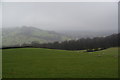
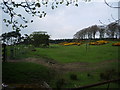
Sheep on the side of Clerk Hill
It is a misty day, but Whalley Nab is still visible opposite. Spring Wood is at the bottom.
Image: © Bill Boaden
Taken: 12 Feb 2011
0.23 miles