
IMAGES TAKEN NEAR TO
Leys Close, CLITHEROE, BB7 9DA
Introduction
This page details the photographs taken nearby to Leys Close, BB7 9DA by members of the Geograph project.
The Geograph project started in 2005 with the aim of publishing, organising and preserving representative images for every square kilometre of Great Britain, Ireland and the Isle of Man.

There are currently over 7.5m images from over14,400 individuals and you can help contribute to the project by visiting https://www.geograph.org.uk
Image Map
Images are licensed for reuse under creativecommons.org/licenses/by-sa/2.0
Notes
- Clicking on the map will re-center to the selected point.
- The higher the marker number, the further away the image location is from the centre of the postcode.
Image Listing (30 Images Found)
Images are licensed for reuse under creativecommons.org/licenses/by-sa/2.0
Image
Details
Distance
1
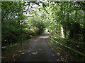
Moor Side Lane, Wiswell
A path at the top of the lane leads up to Wiswell Moor. Locally, the pronunciation of the village name is Wizzle.
Image: © philandju
Taken: 22 Sep 2011
0.05 miles
2
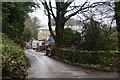
New development on Moor Side Lane
There is a lot of money being invested in this, and you have to hope it will blend in eventually.
Image: © Bill Boaden
Taken: 12 Feb 2011
0.06 miles
3
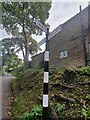
Direction Sign ? Signpost
Located on the east side of the T junction of Cunliffe Lane and Pendleton Road in Wiswell parish. 3 arms and bishop finial. For an older photo before the arms and finial were replaced, see https://www.geograph.org.uk/photo/6663984. This fingerpost has been renovated by Duncan Armstrong.
Milestone Society National ID: LA_SD7437C
Image: © D Phillips
Taken: 17 Sep 2020
0.08 miles
4
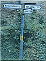
Direction Sign ? Signpost in Wiswell
Located on the east side of the T junction of Cunliffe Lane and Pendleton Road in Wiswell parish. 3 arms and bishop finial. For a more recent photo after the arms and finial were replaced, see https://www.geograph.org.uk/photo/6624521.
Milestone Society National ID: LA_SD7437C
Image: © D Armstrong
Taken: Unknown
0.08 miles
5

Woodland at the top of Moor Side Lane
The path up to Wiswell Moor follows the side of a clough.
Image: © Bill Boaden
Taken: 12 Feb 2011
0.10 miles
6
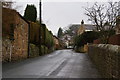
Pendleton Road, Wiswell
All the roads in this village are now quiet like back roads since the A59 and A671 improvements.
Image: © Bill Boaden
Taken: 12 Feb 2011
0.14 miles
7
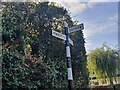
Direction Sign ? Signpost
Located on the southeast side of the junction of Cunliffe Lane and Back Lane in Wiswell parish. 3 arms and bishop finial. For an older photo before the arms and finial were replaced, see https://www.geograph.org.uk/photo/6663242. This fingerpost has been renovated by Duncan Armstrong.
Milestone Society National ID: LA_SD7437B
Image: © D Phillips
Taken: 28 Sep 2020
0.14 miles
8
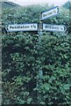
Direction Sign ? Signpost in Wiswell
Located on the southeast side of the junction of Cunliffe Lane and Back Lane in Wiswell parish. 3 arms and bishop finial. For an newer photo after the arms and finial were replaced, see https://www.geograph.org.uk/photo/6623290.
Milestone Society National ID: LA_SD7437B
Image: © D Armstrong
Taken: Unknown
0.14 miles
9
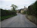
Pendleton Road, Wiswell
Quiet corner of a quiet village.
Image: © Chris Heaton
Taken: 27 Apr 2010
0.14 miles
10
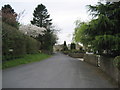
Back Lane, Wiswell
Residential lane in this tidy little village.
Image: © Chris Heaton
Taken: 27 Apr 2010
0.16 miles