
IMAGES TAKEN NEAR TO
Sawley, CLITHEROE, BB7 4NH
Introduction
This page details the photographs taken nearby to BB7 4NH by members of the Geograph project.
The Geograph project started in 2005 with the aim of publishing, organising and preserving representative images for every square kilometre of Great Britain, Ireland and the Isle of Man.

There are currently over 7.5m images from over14,400 individuals and you can help contribute to the project by visiting https://www.geograph.org.uk
Image Map
Images are licensed for reuse under creativecommons.org/licenses/by-sa/2.0
Notes
- Clicking on the map will re-center to the selected point.
- The higher the marker number, the further away the image location is from the centre of the postcode.
Image Listing (113 Images Found)
Images are licensed for reuse under creativecommons.org/licenses/by-sa/2.0
Image
Details
Distance
4
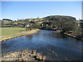
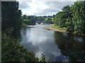
River Ribble at Sawley
Part of the river's finest scenery is to be found at Sawley.
Image: © Chris Heaton
Taken: 2 Mar 2010
0.03 miles
5
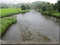
River Ribble from Sawley Bridge
Looking eastward.
Image: © Peter Wood
Taken: 19 Jun 2016
0.03 miles
6
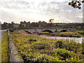
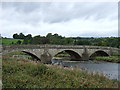
River Ribble, Sawley Bridge
A Grade II listed bridge (http://www.britishlistedbuildings.co.uk/en-183471-sawley-bridge-sawley ) with three segmental circular arches. It carries the minor road between Sawley and Grindleton across the River Ribble, west of the small hamlet of Sawley. It dates from the late 18th century.
Image: © David Dixon
Taken: 3 Aug 2011
0.04 miles
7
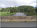
Benchmark on the east parapet of Sawley Bridge
Image: © John Slater
Taken: 19 Sep 2012
0.04 miles
8
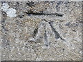
Ordnance Survey Cut Mark
This can be found on the parapet wall of Sawley Bridge.
For more detail see : http://www.bench-marks.org.uk/bm45502
Image: © Peter Wood
Taken: 19 Jun 2016
0.04 miles
10
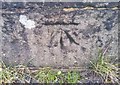
Ordnance Survey Cut Mark
This OS cut mark can be found on the east parapet of Sawley Bridge. It marks a point 73.7067m above mean sea level.
Image: © Adrian Dust
Taken: 24 Nov 2019
0.04 miles