
IMAGES TAKEN NEAR TO
Crow Trees Brow, CLITHEROE, BB7 4AA
Introduction
This page details the photographs taken nearby to Crow Trees Brow, BB7 4AA by members of the Geograph project.
The Geograph project started in 2005 with the aim of publishing, organising and preserving representative images for every square kilometre of Great Britain, Ireland and the Isle of Man.

There are currently over 7.5m images from over14,400 individuals and you can help contribute to the project by visiting https://www.geograph.org.uk
Image Map
Images are licensed for reuse under creativecommons.org/licenses/by-sa/2.0
Notes
- Clicking on the map will re-center to the selected point.
- The higher the marker number, the further away the image location is from the centre of the postcode.
Image Listing (84 Images Found)
Images are licensed for reuse under creativecommons.org/licenses/by-sa/2.0
Image
Details
Distance
2
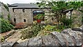
Crow Trees Barn on southeast side of Crow Trees Brow
There is an Ordnance Survey benchmark Image on the front of this barn conversion at its left hand internal angle
Image: © Roger Templeman
Taken: 16 Jul 2024
0.05 miles
3
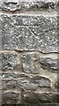
Benchmark on Crow Trees Barn
Ordnance Survey cut mark benchmark levelled at 100.389m above Newlyn Datum verified 1968
Image: © Roger Templeman
Taken: 16 Jul 2024
0.05 miles
4
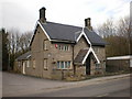
Bold Venture Cottage
To the left was the original entrance to Bold Venture Quarry which was opened in 1836
Image: © Alexander P Kapp
Taken: 31 Jan 2009
0.08 miles
5
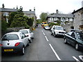
Old Road, Chatburn
The Chatburn end of the old road between Clitheroe and Chatburn, the road no longer exists, it has been quarried by Castle Cement and Tarmac.
Image: © Alexander P Kapp
Taken: 19 Apr 2007
0.08 miles
6

Direction Sign – Signpost in Chatburn
Located on the southeast side of the T-junction of Crow Tree Brow, Bridge Road and Ribble Lane in Chatburn parish. 3 arms and cup & bell finial. The pillar of LA_SD7643, see https://www.geograph.org.uk/photo/6666306 , was moved from SD 7655 4361 and used by Duncan Armstrong as the basis for a traditional fingerpost with new arms.
Milestone Society National ID: LA_SD7644
Image: © D Armstrong
Taken: 1 Jan 2010
0.08 miles
7
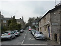
Old Road, Chatburn
Until the early 1970s you were able to drive to Clitheroe using this road and then Castle Cement and Tarmac sort planning permission to quarry the narrow ridge under the road.
Image: © Alexander P Kapp
Taken: 26 Mar 2011
0.08 miles
8
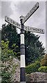
Finger signpost at T-junction in Chatburn
Another view at Image
Image: © Roger Templeman
Taken: 16 Jul 2024
0.08 miles
9
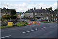
Beginning and end of a diversion
Ribble Lane in Chatburn is closed for resurfacing, and the diversion is quite a long way round.
Image: © Bill Boaden
Taken: 11 Jun 2011
0.08 miles
10
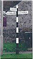
Direction Sign ? Signpost in Chatburn
Located on the southeast side of the T-junction of Crow Tree Brow, Bridge Road and Ribble Lane in Chatburn parish. 3 arms and cup & bell finial. The pillar of LA_SD7643, see https://www.geograph.org.uk/photo/6666306 , was moved from SD 7655 4361 and used by Duncan Armstrong as the basis for a traditional fingerpost with new arms.
Milestone Society National ID: LA_SD7644
Image: © D Armstrong
Taken: Unknown
0.08 miles