
IMAGES TAKEN NEAR TO
Mitton Road, CLITHEROE, BB7 3LZ
Introduction
This page details the photographs taken nearby to Mitton Road, BB7 3LZ by members of the Geograph project.
The Geograph project started in 2005 with the aim of publishing, organising and preserving representative images for every square kilometre of Great Britain, Ireland and the Isle of Man.

There are currently over 7.5m images from over14,400 individuals and you can help contribute to the project by visiting https://www.geograph.org.uk
Image Map
Images are licensed for reuse under creativecommons.org/licenses/by-sa/2.0
Notes
- Clicking on the map will re-center to the selected point.
- The higher the marker number, the further away the image location is from the centre of the postcode.
Image Listing (7 Images Found)
Images are licensed for reuse under creativecommons.org/licenses/by-sa/2.0
Image
Details
Distance
3
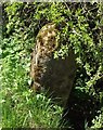
Old Boundary Marker east of Hodder House, Bashall Eaves
Parish Boundary Marker by the UC road, in parish of Bashall Eaves (Ribble Valley District), South of entrance to Hodder House, on verge, West side of road.
Surveyed
Milestone Society National ID: YW_BAEGMI01pb
Image: © Milestone Society
Taken: Unknown
0.16 miles
4
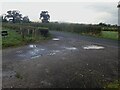
Access from Hodder House
Looking out from the access track for Hodder House at Mitton Road and the gate to a field opposite. An earlier view looking in the opposite direction down the access track can be seen here https://www.geograph.org.uk/photo/2975794
Image: © Steve Houldsworth
Taken: 8 Oct 2024
0.17 miles
5
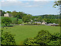
Chaigley Manor
Chaigley Manor and Manor farm
Image: © Tony Mercer
Taken: 15 May 2008
0.19 miles
6
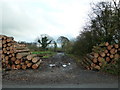
Temporary track
Being used as access to Moss Wood whilst clearing trees
Image: © Alexander P Kapp
Taken: 13 Nov 2011
0.19 miles
7
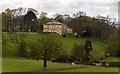
Chaigley Manor
Chaigley Manor above the River Hodder.
Image: © Peter McDermott
Taken: 4 May 2015
0.22 miles