
IMAGES TAKEN NEAR TO
Clitheroe Road, CLITHEROE, BB7 3DA
Introduction
This page details the photographs taken nearby to Clitheroe Road, BB7 3DA by members of the Geograph project.
The Geograph project started in 2005 with the aim of publishing, organising and preserving representative images for every square kilometre of Great Britain, Ireland and the Isle of Man.

There are currently over 7.5m images from over14,400 individuals and you can help contribute to the project by visiting https://www.geograph.org.uk
Image Map
Images are licensed for reuse under creativecommons.org/licenses/by-sa/2.0
Notes
- Clicking on the map will re-center to the selected point.
- The higher the marker number, the further away the image location is from the centre of the postcode.
Image Listing (26 Images Found)
Images are licensed for reuse under creativecommons.org/licenses/by-sa/2.0
Image
Details
Distance
1
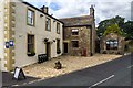
Red Pump Inn
The Red Pump Inn at Bashall Eaves.
Image: © Peter McDermott
Taken: 5 Sep 2015
0.01 miles
3
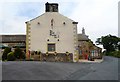
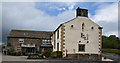
The Red Pump Inn, Bashall Eaves
Excellent pub with character, serving flavoursome local food and beer.
Image: © Bill Boaden
Taken: 28 Nov 2014
0.02 miles
5
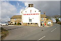
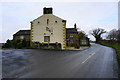
The Red Pump Inn
With the number of red pumps and name signs it could be difficult to change the name to something else
Image: © Alexander P Kapp
Taken: 14 Mar 2007
0.02 miles
6
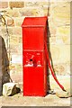
Red pump
One of the many pumps at The Red Pump Inn. The date on the pump has been defaced and it reads 18-2
Image: © Alexander P Kapp
Taken: 14 Mar 2007
0.03 miles
7
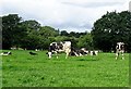
Cows at pasture
Recent rains have facilitated lush feeding for the cattle.
Image: © philandju
Taken: 7 Aug 2019
0.06 miles
8
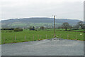
Farmland near Bashall Eaves
Looking towards Longridge Fell from the car park of the Red Pump Inn, some of which can be seen in the foreground.
Image: © Bill Boaden
Taken: 15 Apr 2022
0.07 miles
9
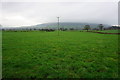
Farmland near Bashall Eaves
Looking towards Longridge Fell which is in cloud.
Image: © Bill Boaden
Taken: 28 Nov 2014
0.08 miles
10
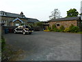
Bashall Eaves Village Hall
The building to the left is the old school, which had a extension built, which is now the village hall, the old school has been converted into housing.
Image: © Alexander P Kapp
Taken: 23 May 2012
0.08 miles