
IMAGES TAKEN NEAR TO
Union Street, CLITHEROE, BB7 2NH
Introduction
This page details the photographs taken nearby to Union Street, BB7 2NH by members of the Geograph project.
The Geograph project started in 2005 with the aim of publishing, organising and preserving representative images for every square kilometre of Great Britain, Ireland and the Isle of Man.

There are currently over 7.5m images from over14,400 individuals and you can help contribute to the project by visiting https://www.geograph.org.uk
Image Map
Images are licensed for reuse under creativecommons.org/licenses/by-sa/2.0
Notes
- Clicking on the map will re-center to the selected point.
- The higher the marker number, the further away the image location is from the centre of the postcode.
Image Listing (59 Images Found)
Images are licensed for reuse under creativecommons.org/licenses/by-sa/2.0
Image
Details
Distance
1
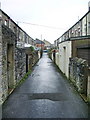
Back street
Back street between Union Street and Nelson Street
Image: © Alexander P Kapp
Taken: 4 May 2008
0.02 miles
4
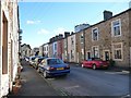
Nelson Street, Low Moor, Clitheroe
On Clitheroe Walks, Walk No 1 http://www.visitlancashire.com/things-to-do/walking-routes/walks-under-5-miles . Industrial housing for the workers at Clitheroe's first cotton mill - built at Low Moor in 1782.
Image: © Christine Johnstone
Taken: 12 Mar 2013
0.05 miles
5
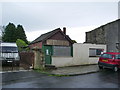
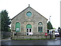
Formerly the local fish and chip shop
Image: © Alexander P Kapp
Taken: 4 May 2008
0.05 miles
6
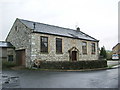
Former Wesleyan Methodist Chapel
Originally the building was the Chapel them a new one was built at the end of Nelson Street, when it was used as a Sunday School. Now it is a house and workshop
Image: © Alexander P Kapp
Taken: 4 May 2008
0.06 miles
7
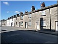
Mill workers' houses, St Paul's Street, Low Moor
Clitheroe's first cotton spinning mill was built in Low Moor in 1782, and terraces like these were built to house the workers. For details of Clitheroe's built history, see www.lancashire.gov.uk/ environment/ documents/ historictowns/ ClitheroeComplete_LowRes.pdf .
Image: © Christine Johnstone
Taken: 12 Mar 2013
0.07 miles
8
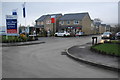
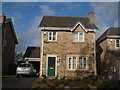
Low Moor Gardens
New greenfield housing on the edge of Low Moor.
Image: © Bill Boaden
Taken: 20 Dec 2013
0.08 miles
10
Low Moor Gardens
Taylow Wimpey's housing development on the northern edge of Low Moor, Clitheroe.
Image: © Christine Johnstone
Taken: 12 Mar 2013
0.09 miles