IMAGES TAKEN NEAR TO
Faraday Avenue, CLITHEROE, BB7 2LW
Introduction
This page details the photographs taken nearby to Faraday Avenue, BB7 2LW by members of the Geograph project.
The Geograph project started in 2005 with the aim of publishing, organising and preserving representative images for every square kilometre of Great Britain, Ireland and the Isle of Man.

There are currently over 7.5m images from over14,400 individuals and you can help contribute to the project by visiting https://www.geograph.org.uk
Image Map (Loading...)


Getting Data...Please wait
Leaflet Map data © OpenStreetMap
Images are licensed for reuse under creativecommons.org/licenses/by-sa/2.0
Notes
- Clicking on the map will re-center to the selected point.
- The higher the marker number, the further away the image location is from the centre of the postcode.
Image Listing (41 Images Found)
Images are licensed for reuse under creativecommons.org/licenses/by-sa/2.0
Image
Details
Distance
2
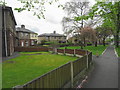
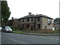
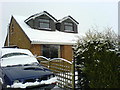
Interwar council housing
The small grass crescent is a common feature in 1920s council estates.
Image: © John M
Taken: 9 May 2018
0.07 miles
9
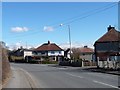
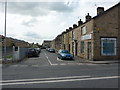
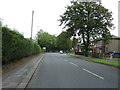
The junction of Edisford Road and Seedall Avenue
A 68 metre spot height.
Image: © Christine Johnstone
Taken: 12 Mar 2013
0.11 miles