
IMAGES TAKEN NEAR TO
Barker Terrace, CLITHEROE, BB7 2HT
Introduction
This page details the photographs taken nearby to Barker Terrace, BB7 2HT by members of the Geograph project.
The Geograph project started in 2005 with the aim of publishing, organising and preserving representative images for every square kilometre of Great Britain, Ireland and the Isle of Man.

There are currently over 7.5m images from over14,400 individuals and you can help contribute to the project by visiting https://www.geograph.org.uk
Image Map
Images are licensed for reuse under creativecommons.org/licenses/by-sa/2.0
Notes
- Clicking on the map will re-center to the selected point.
- The higher the marker number, the further away the image location is from the centre of the postcode.
Image Listing (334 Images Found)
Images are licensed for reuse under creativecommons.org/licenses/by-sa/2.0
Image
Details
Distance
2
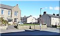
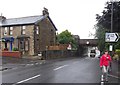
Watch your speed on Waddington Road, Clitheroe
The illuminated sign is frowning because someone has just driven past at 28mph in a 20mph zone. When drivers do 20mph or less, they get a smiley face.
Image: © Christine Johnstone
Taken: 12 Mar 2013
0.02 miles
3
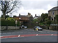
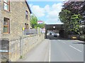
Waddington Road Railway Bridge
Carries the Clitheroe to Hellifield Railway over Waddington Road
Image: © Alexander P Kapp
Taken: 12 Apr 2008
0.04 miles
7
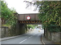
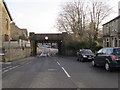
Railway bridge over Waddington Road (B6478). Clitheroe
Image: © JThomas
Taken: 1 Oct 2016
0.04 miles
8
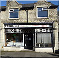
We Will Mend It
The sort of shop frontage that gives a man of a certain age the assurance before even setting foot inside that his vintage Roberts radio, non-digital version, will not only be repaired but restored to as good as new. But with those lovely old window frames why did they have to put that Expelair there?
Image: © Steve Reeves
Taken: 30 Oct 2010
0.05 miles
10
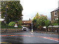
Waddington Road railway bridge, Clitheroe
The road dips under the bridge, hence the "road liable to flooding" sign. Flooding was a problem here when I lived in the area in the 1960s, and obviously still is. But if I recall correctly, traffic coming under the bridge had priority over traffic coming along Railway View in those days.
Image: © Stephen Craven
Taken: 13 Oct 2018
0.05 miles