
IMAGES TAKEN NEAR TO
Church Close, CLITHEROE, BB7 2HQ
Introduction
This page details the photographs taken nearby to Church Close, BB7 2HQ by members of the Geograph project.
The Geograph project started in 2005 with the aim of publishing, organising and preserving representative images for every square kilometre of Great Britain, Ireland and the Isle of Man.

There are currently over 7.5m images from over14,400 individuals and you can help contribute to the project by visiting https://www.geograph.org.uk
Image Map
Images are licensed for reuse under creativecommons.org/licenses/by-sa/2.0
Notes
- Clicking on the map will re-center to the selected point.
- The higher the marker number, the further away the image location is from the centre of the postcode.
Image Listing (641 Images Found)
Images are licensed for reuse under creativecommons.org/licenses/by-sa/2.0
Image
Details
Distance
1
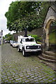
Camera for looking over high walls
Image: © Alexander P Kapp
Taken: 21 Sep 2012
0.01 miles
2

St Mary Magdalene C Of E Church, Clitheroe
This view was taken from Clitheroe Castle. In the background is the cement works - a major local employer.
Image: © John Tustin
Taken: 15 Jun 2010
0.02 miles
3

Bench mark and bolt on St Mary's porch
This bench mark and bolt is on the west face of the porch of St Mary's. It is first recorded on the 1849 Town Plans levelled at 310.4 feet. See also Image
Image: © John S Turner
Taken: 28 Apr 2011
0.02 miles
4

The porch of St Mary Magdalene, Clitheroe
The porch of St Mary's is at the west end of the church, next to the tower. There is a bench mark and bolt on the left-hand side of the porch door - Image
Image: © John S Turner
Taken: 28 Apr 2011
0.02 miles
5

St Mary's churchyard
Looking across the well-maintained graveyard of the church of St Mary Magdalene.
Image: © John S Turner
Taken: 28 Apr 2011
0.02 miles
6

St. Mary Magdalene C of E Church
The C of E church is the parish church of the small town of Clitheroe.
Image: © Malcolm Neal
Taken: 28 Oct 2011
0.02 miles
7

It must be nearly there
The scaffolding has grown a bit more. The rebuild of St Mary's Spire
Image: © Alexander P Kapp
Taken: 18 Oct 2012
0.02 miles
8

The Church of St Mary Magdalene at Clitheroe
Viewed from the south.
Image: © Peter Wood
Taken: 30 May 2014
0.02 miles
9

St Mary Magdalene Church
The spire is an Ordnance Survey intersected station trig point, https://trigpointing.uk/trig/14673
Image: © Roger Templeman
Taken: 13 Jul 2024
0.02 miles
10
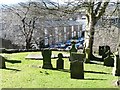
Brennand Street, Clitheroe
Seen from the churchyard off Church Street.
Image: © Christine Johnstone
Taken: 12 Mar 2013
0.02 miles