IMAGES TAKEN NEAR TO
Worston, CLITHEROE, BB7 1QA
Introduction
This page details the photographs taken nearby to BB7 1QA by members of the Geograph project.
The Geograph project started in 2005 with the aim of publishing, organising and preserving representative images for every square kilometre of Great Britain, Ireland and the Isle of Man.

There are currently over 7.5m images from over14,400 individuals and you can help contribute to the project by visiting https://www.geograph.org.uk
Image Map
Images are licensed for reuse under creativecommons.org/licenses/by-sa/2.0
Notes
- Clicking on the map will re-center to the selected point.
- The higher the marker number, the further away the image location is from the centre of the postcode.
Image Listing (38 Images Found)
Images are licensed for reuse under creativecommons.org/licenses/by-sa/2.0
Image
Details
Distance
1

Footbridge at Worston
Spanning Worston Brook.
Image: © philandju
Taken: 12 Jul 2012
0.02 miles
4
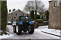
Tractors in Worston
These appeared to be meeting up with others on the A59 for a tractor rally.
Image: © Bill Boaden
Taken: 3 Jan 2010
0.02 miles
5
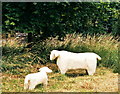
Worston sheep
Not very frisky!
Image: © Mike and Kirsty Grundy
Taken: 4 Aug 2005
0.04 miles
7
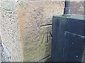
Ordnance Survey Cut Mark
This can be found on the wall of a building at the Calf's Head PH in Worston.
For more detail see : http://www.bench-marks.org.uk/bm80920
Image: © Peter Wood
Taken: 14 Dec 2016
0.06 miles
8
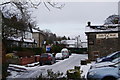
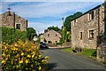
The main street in Worston
There didn't appear to be anything here apart from the pub and some houses.
Image: © Bill Boaden
Taken: 3 Jan 2010
0.06 miles
9
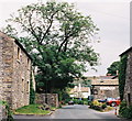
Worston
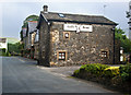
Looking East to the Calf's Head (famous for food)
Image: © Mike and Kirsty Grundy
Taken: 1 Aug 2005
0.06 miles