
IMAGES TAKEN NEAR TO
Lyndon Avenue, BLACKBURN, BB6 7TP
Introduction
This page details the photographs taken nearby to Lyndon Avenue, BB6 7TP by members of the Geograph project.
The Geograph project started in 2005 with the aim of publishing, organising and preserving representative images for every square kilometre of Great Britain, Ireland and the Isle of Man.

There are currently over 7.5m images from over14,400 individuals and you can help contribute to the project by visiting https://www.geograph.org.uk
Image Map
Images are licensed for reuse under creativecommons.org/licenses/by-sa/2.0
Notes
- Clicking on the map will re-center to the selected point.
- The higher the marker number, the further away the image location is from the centre of the postcode.
Image Listing (26 Images Found)
Images are licensed for reuse under creativecommons.org/licenses/by-sa/2.0
Image
Details
Distance
1
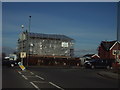
Plastic House
When the plastic is removed it will have grown up to be a two storey from a one storey house.
Image: © Alexander P Kapp
Taken: 19 Apr 2006
0.09 miles
2

Rotary Club Purple Pinkie
Situated on the area know locally as the triangle, just opposite the junction of Lyndon Avenue and Harwood lane are the Purple Crocuses. These are some of the 40,000 planted across Great Harwood and Rishton by Rotarians with help from children and volunteers to celebrate the Rotarians success towards eradicating Polio from the worlds children.
Since 1983 Rotary Clubs worldwide have worked to reduce the number of children crippled or dying of Polio from 1000 per day to 2 per day in 2011, total eradication is now close.
All children vaccinated have their little fingers dyed purple hence the “Purple Pinkie” represented by these crocuses.
Image: © Steve Houldsworth
Taken: 23 Feb 2019
0.11 miles
3
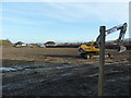
Former football ground
Being prepared for house building.
Image: © Alexander P Kapp
Taken: 17 Nov 2011
0.11 miles
5
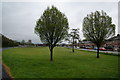
Village green at Harwood Bar
I have been unable to find the history of this, and wonder whether it just developed between a new road and an old road, when the houses to the right were built.
Image: © Bill Boaden
Taken: 12 May 2013
0.12 miles
6
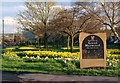
Great Harwood Market Town Sign
This sign was erected at the junction of Harwood Lane and Whalley Road Great Harwood and commemorates the granting of the market charter in 1338.
Image: © Steve Houldsworth
Taken: 5 Apr 2014
0.13 miles
7
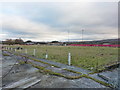
Part of what was Great Harwood Football Ground
Image: © Alexander P Kapp
Taken: 11 Jan 2011
0.13 miles
8

Bus stop and shelter on Harwood Lane, Great Harwood
Looking north east on the B6535.
Image: © JThomas
Taken: 19 Apr 2019
0.14 miles
9
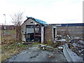
Turnstiles, Great Harwood Football Ground
Image: © Alexander P Kapp
Taken: 11 Jan 2011
0.15 miles
10
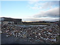
Part of what was Great Harwood Football Ground
Image: © Alexander P Kapp
Taken: 11 Jan 2011
0.15 miles