
IMAGES TAKEN NEAR TO
Windsor Street, ACCRINGTON, BB5 6EF
Introduction
This page details the photographs taken nearby to Windsor Street, BB5 6EF by members of the Geograph project.
The Geograph project started in 2005 with the aim of publishing, organising and preserving representative images for every square kilometre of Great Britain, Ireland and the Isle of Man.

There are currently over 7.5m images from over14,400 individuals and you can help contribute to the project by visiting https://www.geograph.org.uk
Image Map
Images are licensed for reuse under creativecommons.org/licenses/by-sa/2.0
Notes
- Clicking on the map will re-center to the selected point.
- The higher the marker number, the further away the image location is from the centre of the postcode.
Image Listing (104 Images Found)
Images are licensed for reuse under creativecommons.org/licenses/by-sa/2.0
Image
Details
Distance
1
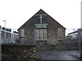
Cambridge Street Methodist Church, Accrington
Image: © Alexander P Kapp
Taken: 23 Apr 2007
0.06 miles
3

Houses on Burnley Road at Foster Street junction
Ordnance Survey documents indicate that a benchmark levelled at 155.911m above Newlyn Datum was verified in 1961 on the left hand corner of the nearest house (#149) on the pebbledashed face
Image: © Roger Templeman
Taken: 20 May 2025
0.08 miles
4
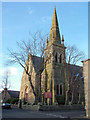
Parish Church of St John the Evangelist
The church was built in 1862-63, and is located at the western end of what is now (2002) Church Walk. Inside the Church at the western end the dominant feature on the south wall is the War Memorial board. This Memorial commemorates the men who gave their lives in both the First and Second World Wars, there are 117 names recorded for the First and 52 on the Second. The 1914 -1918 board was unveiled and dedicated in 1919, and the 1939-1945 board was unveiled at a Dedication Service on Remembrance Sunday, 1947.
Above the names of the 1914-1918 board is the following inscription:-
"In loving and grateful memory of the men of this Parish who gave their lives for King & Country in the Great War 1914-1918. Their names are here recorded to be held in honour for evermore".
Image: © Richard Spencer
Taken: 18 Feb 2006
0.08 miles
5
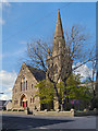
Church of St John the Evangelist
St John's Church, at the junction of Addison Street and Dowry Street, is a Grade II listed building, dating from the 1860s (http://www.britishlistedbuildings.co.uk/en-183798-church-of-st-john-the-evangelist-accring British Listed Buildings).
Image: © David Dixon
Taken: 12 May 2012
0.09 miles
6
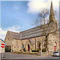
St John's Church
The Church of St John the Evangelist, at the junction of Addison Street and Dowry Street, is a Grade II listed building, dating from the 1860s (http://www.britishlistedbuildings.co.uk/en-183798-church-of-st-john-the-evangelist-accring British Listed Buildings).
Image: © David Dixon
Taken: 12 May 2012
0.10 miles
10
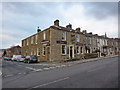
Boars Head, Burnley Road, Accrington
Image: © Alexander P Kapp
Taken: 12 Feb 2010
0.12 miles