
IMAGES TAKEN NEAR TO
Tarn Avenue, ACCRINGTON, BB5 5XT
Introduction
This page details the photographs taken nearby to Tarn Avenue, BB5 5XT by members of the Geograph project.
The Geograph project started in 2005 with the aim of publishing, organising and preserving representative images for every square kilometre of Great Britain, Ireland and the Isle of Man.

There are currently over 7.5m images from over14,400 individuals and you can help contribute to the project by visiting https://www.geograph.org.uk
Image Map
Images are licensed for reuse under creativecommons.org/licenses/by-sa/2.0
Notes
- Clicking on the map will re-center to the selected point.
- The higher the marker number, the further away the image location is from the centre of the postcode.
Image Listing (22 Images Found)
Images are licensed for reuse under creativecommons.org/licenses/by-sa/2.0
Image
Details
Distance
1
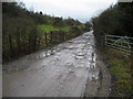
Access Lane to Recycling Operation
Muddy access track leading from the A680 Accrington Road to a recycling operation, beside Hyndburn Brook.
Image: © Chris Heaton
Taken: 2 Feb 2010
0.15 miles
2

Bridge over Harwood Brook
The bridge where Hayes lane crosses over Harwood Brook where Harwood Brook joins the river Hyndburn.
Image: © Steve Houldsworth
Taken: 16 Nov 2013
0.15 miles
4
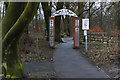
The entrance to The Woodlands, Clayton-le-Moors
Image: © Ian Greig
Taken: 19 Feb 2016
0.16 miles
5
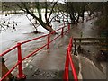
Flooding Heys Lane
The river Hyndburn during flooding covering the path on Heyes Lane, a view of the path under normal condition can be seen at http://www.geograph.org.uk/photo/3747412
Image: © Steve Houldsworth
Taken: 26 Dec 2015
0.16 miles
6
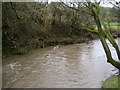
Hyndburn Brook
The watercourse in full spate slightly upstream from Hyndburn Bridge on the A680.
Image: © Chris Heaton
Taken: 2 Feb 2010
0.17 miles
7

Footbridge on the river Hyndburn
The footbridge at the bottom of Heyes Lane leading over the river Hyndburn and onto the car park at the rear of the Hyndburn Bridge Inn.
Image: © Steve Houldsworth
Taken: 16 Nov 2013
0.17 miles
8
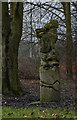
A wood carving at The Woodlands, Clayton-le-Moors
I don’t know what it is, but it’s unlikely to be Snoopy the dog
Image: © Ian Greig
Taken: 19 Feb 2016
0.17 miles
9

Footbridge over the river Hyndburn
The footbridge over the river leads to Heys Lane at this point. All the trees have been cut back around this footbridge and the wall to the left is starting to break up. An earlier image at this position at autumn can be found here :- https://www.geograph.org.uk/photo/3747394
Image: © Steve Houldsworth
Taken: 10 Jun 2026
0.17 miles
10

Footbridge over the river Hyndburn
Footbridge over the river Hyndburn at the rear of the Hyndburn Bridge Inn, the bridge leads to the bottom of Heyes Lane.
Image: © Steve Houldsworth
Taken: 16 Nov 2013
0.17 miles