
IMAGES TAKEN NEAR TO
Hyndburn Road, ACCRINGTON, BB5 4AA
Introduction
This page details the photographs taken nearby to Hyndburn Road, BB5 4AA by members of the Geograph project.
The Geograph project started in 2005 with the aim of publishing, organising and preserving representative images for every square kilometre of Great Britain, Ireland and the Isle of Man.

There are currently over 7.5m images from over14,400 individuals and you can help contribute to the project by visiting https://www.geograph.org.uk
Image Map
Images are licensed for reuse under creativecommons.org/licenses/by-sa/2.0
Notes
- Clicking on the map will re-center to the selected point.
- The higher the marker number, the further away the image location is from the centre of the postcode.
Image Listing (21 Images Found)
Images are licensed for reuse under creativecommons.org/licenses/by-sa/2.0
Image
Details
Distance
2
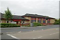
Hyndburn fire station
Hyndburn fire station, Hyndburn Road, Church, Accrington, Lancashire
Image: © Kevin Hale
Taken: 4 Jun 2009
0.06 miles

4

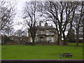
Ivy Cottage, Hyndburn Road
Ivy and Rose Cottages, St Oswald's Church was situated on Hyndburn Road between Elmfield House (later Gatty Park) and Hags Mill at the bottom of the footpath known locally as 'Owd bob's'
It was built in 1852 and ceased to be a church when the Sacred Heart Church was built on Blackburn Road in 1869. The building survived until the outbreak of the second world war being latterly used for storing tyres. It was destroyed by fire on the morning of 16th October 1943. The building comprised a central nave and two transepts. The transepts survived the fire and were converted into houses. They can still be seen on Hyndburn Road.
Thanks to Accrington Web
Image: © Robert Wade
Taken: 8 Apr 2009
0.12 miles
6
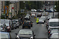
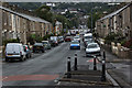
A lollipop man at work in Peel Bank
It looks hazardous!
Image: © Ian Greig
Taken: 9 Sep 2016
0.16 miles
8
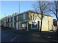
Small superstore on Dill Hill Lane (B6231), Church
Image: © JThomas
Taken: 26 Nov 2016
0.16 miles
10
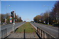
Dunkenhalgh Way, Accrington
The A6185, also known as Hyndburn Road, which is the main link between Accrington and the M65.
Image: © Bill Boaden
Taken: 2 Mar 2013
0.18 miles