IMAGES TAKEN NEAR TO
Hornby Street, ACCRINGTON, BB5 3AG
Introduction
This page details the photographs taken nearby to Hornby Street, BB5 3AG by members of the Geograph project.
The Geograph project started in 2005 with the aim of publishing, organising and preserving representative images for every square kilometre of Great Britain, Ireland and the Isle of Man.

There are currently over 7.5m images from over14,400 individuals and you can help contribute to the project by visiting https://www.geograph.org.uk
Image Map
Images are licensed for reuse under creativecommons.org/licenses/by-sa/2.0
Notes
- Clicking on the map will re-center to the selected point.
- The higher the marker number, the further away the image location is from the centre of the postcode.
Image Listing (143 Images Found)
Images are licensed for reuse under creativecommons.org/licenses/by-sa/2.0
Image
Details
Distance
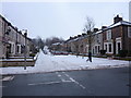
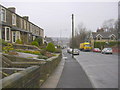
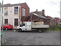
7
Looking towards Charles Street
Taken from a tenfoot at the rear of Catlow Hall Street
Image: © Ian S
Taken: 2 Oct 2011
0.08 miles
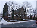
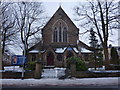
9
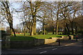
Rhyddings Park
Now a municipal park, but formerly the residence of a local mill-owner.
Image: © Bill Boaden
Taken: 5 Jan 2013
0.08 miles
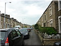
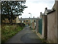
10
Back Heyes Lane-Catlow Hall Street, Oswaldtwistle
Image: © Robert Wade
Taken: 19 Aug 2011
0.09 miles