
IMAGES TAKEN NEAR TO
Royds Avenue, ACCRINGTON, BB5 2LE
Introduction
This page details the photographs taken nearby to Royds Avenue, BB5 2LE by members of the Geograph project.
The Geograph project started in 2005 with the aim of publishing, organising and preserving representative images for every square kilometre of Great Britain, Ireland and the Isle of Man.

There are currently over 7.5m images from over14,400 individuals and you can help contribute to the project by visiting https://www.geograph.org.uk
Image Map
Images are licensed for reuse under creativecommons.org/licenses/by-sa/2.0
Notes
- Clicking on the map will re-center to the selected point.
- The higher the marker number, the further away the image location is from the centre of the postcode.
Image Listing (74 Images Found)
Images are licensed for reuse under creativecommons.org/licenses/by-sa/2.0
Image
Details
Distance
1
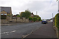
Woodley Avenue, Accrington
In the 1970's there used to be a big metal "barn", in the centre of the picture, where the council kept a couple of vehicles. One was a tractor and the other was something else. I can remember looking under the doors to see which one was at the front.
Image: © Stuart Wilding
Taken: 17 Sep 2014
0.05 miles
3
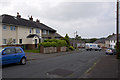
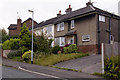
Woodley Avenue, Accrington
The house on the left was the childhood home of Lancashire County cricketer, Bob Ratcliffe. Though it wasn't quite so big then.
Bob took 3 for 25 as Lancashire went on to beat Middlesex by 7 wickets in the 1975 Gillette Cup Final.
Image: © Stuart Wilding
Taken: 17 Sep 2014
0.06 miles
5

King George V Playing Fields, Accrington
Playing fields, changing rooms and car park.
Image: © Chris Heaton
Taken: 5 Sep 2018
0.09 miles
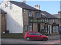
7
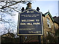
Oak Hill Park, Sign
The Oak Hill estate dates back to the middle of the 18th Century and belonged to the Woodward Family. In 1815 the land was purchased by Thomas Hargreaves, head of the Broad Oak Print Works. The present mansion was built soon after the purchase of the land. http://www.hyndburnbc.gov.uk/site/scripts/documents_info.php?documentID=48&pageNumber=4
Image: © Alexander P Kapp
Taken: 14 Feb 2008
0.11 miles
8
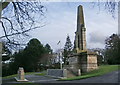
Oak Hill Park, Accrington, War Memorial
http://ww1cemeteries.com/british_cemeteries_memorials_ext/accrington_wm.htm
Image: © Alexander P Kapp
Taken: 14 Feb 2008
0.12 miles
9
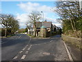
Royds Street to the left and Hollins Lane to the right, Accrington
Image: © Alexander P Kapp
Taken: 12 Feb 2010
0.12 miles
10

Female figure on Accrington Cenotaph
According to the notes written at the time of the unveiling of the World War One cenotaph in 1922, this female figure represents "Compassion" and "Piety". She holds a wreath and a palm leaf.
Image: © Neil Theasby
Taken: 9 Nov 2014
0.12 miles