
IMAGES TAKEN NEAR TO
Wooley Lane, ACCRINGTON, BB5 2EA
Introduction
This page details the photographs taken nearby to Wooley Lane, BB5 2EA by members of the Geograph project.
The Geograph project started in 2005 with the aim of publishing, organising and preserving representative images for every square kilometre of Great Britain, Ireland and the Isle of Man.

There are currently over 7.5m images from over14,400 individuals and you can help contribute to the project by visiting https://www.geograph.org.uk
Image Map
Images are licensed for reuse under creativecommons.org/licenses/by-sa/2.0
Notes
- Clicking on the map will re-center to the selected point.
- The higher the marker number, the further away the image location is from the centre of the postcode.
Image Listing (7 Images Found)
Images are licensed for reuse under creativecommons.org/licenses/by-sa/2.0
Image
Details
Distance
1
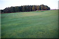
Baxenden and District Golf Club
A 9-hole course between Baxenden and the Accrington by-pass. A footpath crosses the course here.
Image: © Bill Boaden
Taken: 6 Nov 2011
0.15 miles
2
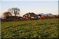
Unnamed farm near Baxenden
The entrance to this farm is on the other side but there was no name shown there. Here it is seen in autumn evening light.
Image: © Bill Boaden
Taken: 6 Nov 2011
0.17 miles
3
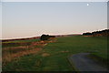
Moon over Baxenden and District Golf Club
Image: © Bill Boaden
Taken: 6 Nov 2011
0.22 miles
4
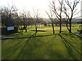
Baxenden and District Golf Course
They have an 18 hole golf course.
Image: © Richard Spencer
Taken: 18 Feb 2006
0.23 miles
5

A neglected section of path
The stile on the left is an indication. From there you have to get to the gate on the right, but my footwear on this occasion was too light to attempt the deep and soft mud. Beyond is Great Hameldon.
Image: © Bill Boaden
Taken: 6 Nov 2011
0.23 miles
6
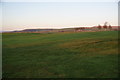
The top end of Baxenden Golf Course
In the distance you can just see the Accrington by-pass running in front of Great Hameldon.
Image: © Bill Boaden
Taken: 6 Nov 2011
0.24 miles
7
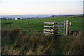
Path above Gallows Hall Farm
Gallows Hall Farm is to the left. Accrington is down in the dip beyond, while the Bowland hills are on the skyline.
Image: © Bill Boaden
Taken: 6 Nov 2011
0.24 miles