IMAGES TAKEN NEAR TO
Buxton Street, ACCRINGTON, BB5 0SF
Introduction
This page details the photographs taken nearby to Buxton Street, BB5 0SF by members of the Geograph project.
The Geograph project started in 2005 with the aim of publishing, organising and preserving representative images for every square kilometre of Great Britain, Ireland and the Isle of Man.

There are currently over 7.5m images from over14,400 individuals and you can help contribute to the project by visiting https://www.geograph.org.uk
Image Map
Images are licensed for reuse under creativecommons.org/licenses/by-sa/2.0
Notes
- Clicking on the map will re-center to the selected point.
- The higher the marker number, the further away the image location is from the centre of the postcode.
Image Listing (26 Images Found)
Images are licensed for reuse under creativecommons.org/licenses/by-sa/2.0
Image
Details
Distance
1
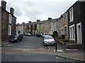
Buxton Street, Oswaldtwistle,
View up from Charter Street.
Image: © JThomas
Taken: 10 Sep 2018
0.03 miles
2
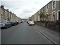
Charter Street, Oswaldtwistle
Looking north east.
Image: © JThomas
Taken: 10 Sep 2018
0.04 miles
3
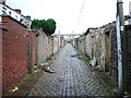
Back Street, Accrington
Runs parallel with Charter Street
Image: © Alexander P Kapp
Taken: 12 Sep 2008
0.06 miles
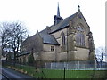
4
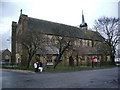
The Parish Church of St Peter, Accrington
Image: © Alexander P Kapp
Taken: 14 Jan 2008
0.09 miles
5
The Parish Church of St Peter, Accrington
Image: © Alexander P Kapp
Taken: 14 Jan 2008
0.09 miles
6
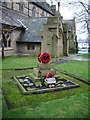
The Parish Church of St Peter, Accrington, War Memorial
Image: © Alexander P Kapp
Taken: 14 Jan 2008
0.09 miles
7
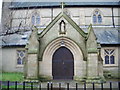
The Parish Church of St Peter, Accrington, Porch
Image: © Alexander P Kapp
Taken: 14 Jan 2008
0.09 miles
8
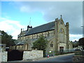
The Parish Church of St Peter, Accrington
Image: © Alexander P Kapp
Taken: 21 Aug 2006
0.13 miles
9
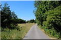
Hyndburn Greenway (2)
Section of Cycle Route No.6 in Accrington, Lancashire
Image: © Chris Heaton
Taken: 4 Jul 2018
0.13 miles
10
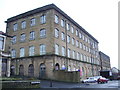
Globe Works on Richmond Hill Street, Accrington
Image: © Alexander P Kapp
Taken: 14 Jan 2008
0.15 miles