
IMAGES TAKEN NEAR TO
Pinch Clough Road, ROSSENDALE, BB4 9RT
Introduction
This page details the photographs taken nearby to Pinch Clough Road, BB4 9RT by members of the Geograph project.
The Geograph project started in 2005 with the aim of publishing, organising and preserving representative images for every square kilometre of Great Britain, Ireland and the Isle of Man.

There are currently over 7.5m images from over14,400 individuals and you can help contribute to the project by visiting https://www.geograph.org.uk
Image Map
Images are licensed for reuse under creativecommons.org/licenses/by-sa/2.0
Notes
- Clicking on the map will re-center to the selected point.
- The higher the marker number, the further away the image location is from the centre of the postcode.
Image Listing (19 Images Found)
Images are licensed for reuse under creativecommons.org/licenses/by-sa/2.0
Image
Details
Distance
1
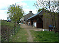
Pennine Bridleway, Lumb
This farm is on the line of the Pennine Bridleway National Trail and has facilities for stabling.
Image: © michael ely
Taken: 18 May 2008
0.05 miles
2
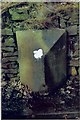
Old Milestone by the B6238, Burnley Road East, Rawtenstall parish
Carved stone post by the B6238, in parish of RAWTENSTALL (ROSSENDALE District), Lumb, Burnley Road East, in front wall, on West side of road. Erected by the Haslingden & Todmorden turnpike trust in the 19th century.
Inscription reads:-
: {arrow->} / BURNLEY / 6¼ MILES : : LUMB : : {<-arrow} / WATERFOOT / 2 MILES :
Milestone Society National ID: LA_WTBU02.
Image: © J Higgins
Taken: 1 Mar 2009
0.11 miles
4
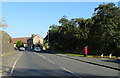
Burnley Road East (B6238), Lumb
Showing position of Postbox No. BB4 523.
See Image] for postbox.
Image: © JThomas
Taken: 10 Oct 2018
0.14 miles
5
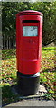
Elizabeth II postbox on Burnley Road East, Lumb
Postbox No. BB4 523.
See Image] for context.
Image: © JThomas
Taken: 10 Oct 2018
0.14 miles
6
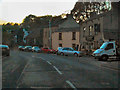
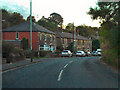
Lumb
Burnley Road East (B6238), passing through Lumb. The Hargreaves Arms is on the right hand side.
Image: © David Dixon
Taken: 7 Oct 2010
0.15 miles
7
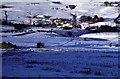
Lumb in the snow
The village of Lumb. St Michael's church is on the hillside to the right. The derelict building on the left is Hoyle Dean.
Image: © John Aspden
Taken: Unknown
0.15 miles
8

The Pennine Bridleway Mary Towneley loop near Lumb
Image: © Dave Kelly
Taken: 4 Jul 2019
0.15 miles
9
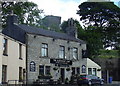
Hargreaves Arms (Pub) 910 Burnley Road East, Rossendale BB4 9PQ
August 2025 closed
Image: © Robert Wade
Taken: 23 Jul 2007
0.15 miles
10

Old Milestone by the B6238, Burnley Road East
Carved stone post by the B6238, in parish of RAWTENSTALL (ROSSENDALE District), Lumb, between Lumb and Whitewell Bottom, opposite No. 691, by the road, on West side of road. Erected by the Haslingden & Todmorden turnpike trust in the 19th century. Only recorded on maps up to 1894.
Inscription once read:-
(Burnley)
(6)
(Waterfoot)
(2)
Milestone Society National ID: LA_WTBU03.
Image: © J Higgins
Taken: 1 Mar 2009
0.15 miles