
IMAGES TAKEN NEAR TO
Burnley Road East, ROSSENDALE, BB4 9NJ
Introduction
This page details the photographs taken nearby to Burnley Road East, BB4 9NJ by members of the Geograph project.
The Geograph project started in 2005 with the aim of publishing, organising and preserving representative images for every square kilometre of Great Britain, Ireland and the Isle of Man.

There are currently over 7.5m images from over14,400 individuals and you can help contribute to the project by visiting https://www.geograph.org.uk
Image Map
Images are licensed for reuse under creativecommons.org/licenses/by-sa/2.0
Notes
- Clicking on the map will re-center to the selected point.
- The higher the marker number, the further away the image location is from the centre of the postcode.
Image Listing (8 Images Found)
Images are licensed for reuse under creativecommons.org/licenses/by-sa/2.0
Image
Details
Distance
1
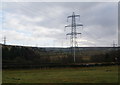
Pylons in Rossendale
How many can you see? These are crossing the Whitewell valley at Water.
Image: © Bill Boaden
Taken: 8 Jan 2011
0.07 miles
2
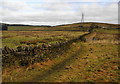
The Rossendale Way going towards Meadows Farm
You can see the dam of Cloughbottom Reservoir far left.
Image: © Bill Boaden
Taken: 8 Jan 2011
0.12 miles
3
Woodland, Forest of Rossendale
Looking east from Burnley Road East (B6238).
Image: © JThomas
Taken: 10 Oct 2018
0.14 miles
4
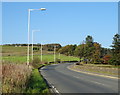
Bend in Burnley Road East (B6238)
Looking north.
Image: © JThomas
Taken: 10 Oct 2018
0.20 miles
5
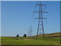
Pylons and power lines
Looking north east from Burnley Road East (B6238).
Image: © JThomas
Taken: 10 Oct 2018
0.20 miles
6
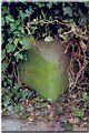
Old Milestone by the B6238, Burnley Road East, Rawtenstall parish
Carved stone post by the B6238, in parish of RAWTENSTALL (ROSSENDALE District), Water, Burnley Road East, 14m South of East Bank, on East side of road. Lancs. CC stone triangle, erected by the County Council in the 19th/20th century.
Inscription reads:-
: {arrow->} / WATERFOOT / 3 MILES : : WATER : : {<-arrow} / BURNLEY / 5¼ MILES :
Milestone Society National ID: LA_WTBU03A.
Image: © J Higgins
Taken: 1 Mar 2009
0.22 miles
7
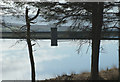
Clough Bottom Reservoir
Next to Windy Bank
Image: © Richard Spencer
Taken: 18 Feb 2006
0.24 miles
8
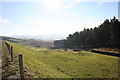
Clough Bottom Reservoir
Overflow from the reservoir to Whitewell Brook
Image: © Kevin Rushton
Taken: 10 Feb 2008
0.24 miles