IMAGES TAKEN NEAR TO
Dearden Heights, ROSSENDALE, BB4 8TW
Introduction
This page details the photographs taken nearby to Dearden Heights, BB4 8TW by members of the Geograph project.
The Geograph project started in 2005 with the aim of publishing, organising and preserving representative images for every square kilometre of Great Britain, Ireland and the Isle of Man.

There are currently over 7.5m images from over14,400 individuals and you can help contribute to the project by visiting https://www.geograph.org.uk
Image Map
Images are licensed for reuse under creativecommons.org/licenses/by-sa/2.0
Notes
- Clicking on the map will re-center to the selected point.
- The higher the marker number, the further away the image location is from the centre of the postcode.
Image Listing (35 Images Found)
Images are licensed for reuse under creativecommons.org/licenses/by-sa/2.0
Image
Details
Distance
3
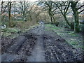
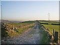
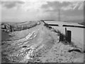
Track
This track leads from Haslingden Old Road to Union Road, and by the look of it could have been well used in days gone bye, but because of its steepness it fell out of favour
Image: © Alexander P Kapp
Taken: 11 Feb 2008
0.05 miles
4
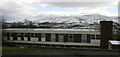
General Hospital
This used to be the maternity wing.
Image: © Robert Wade
Taken: 6 Apr 2008
0.10 miles
5
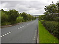
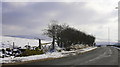
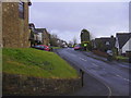
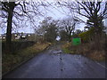
Haslingden Old Road
Looking downhill towards Rawtenstall.
Image: © Robert Wade
Taken: 26 Jul 2007
0.10 miles