IMAGES TAKEN NEAR TO
Greenfold Drive, ROSSENDALE, BB4 8RN

Introduction

This page details the photographs taken nearby to Greenfold Drive, BB4 8RN by members of the Geograph project.

The Geograph project started in 2005 with the aim of publishing, organising and preserving representative images for every square kilometre of Great Britain, Ireland and the Isle of Man.

There are currently over 7.5m images from over14,400 individuals and you can help contribute to the project by visiting https://www.geograph.org.uk

Image Map


Images are licensed for reuse under creativecommons.org/licenses/by-sa/2.0
Notes
  • Clicking on the map will re-center to the selected point.
  • The higher the marker number, the further away the image location is from the centre of the postcode.

Image Listing (42 Images Found)

Images are licensed for reuse under creativecommons.org/licenses/by-sa/2.0
  • ...
Image
Details
Distance
1
Elizabeth II postbox on Burnley Road, Goodshaw
Postbox No. BB4 532. See Image] for context.
Image: © JThomas Taken: 25 Sep 2018
0.14 miles
2
The Jester, Burnley Road
Image: © Alexander P Kapp Taken: 3 Feb 2010
0.14 miles
3
A682, Burnley Road, Goodshaw
Image: © David Dixon Taken: 7 Oct 2010
0.15 miles
4
Houses on Burnley Road, Goodshaw
Showing position of Postbox No. BB4 532. See Image] for postbox.
Image: © JThomas Taken: 25 Sep 2018
0.15 miles
5
Gib Hill Lane
Image: © Alexander P Kapp Taken: 3 Feb 2010
0.15 miles
6
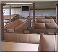
Goodshaw Chapel, Goodshaw, Rossendale, Lancashire
Preserved interior
Image: © Robert Wade Taken: 14 Jul 2011
0.19 miles
7
The Old Baptist Chapel, Goodshaw
The only non conformist chapel to fall under the guardianship of English Heritage. Built in 1760, it later fell into disrepair before a fairly recent project restored the building to its former glory. Both the chapel and grounds are locked, due to vandalism.
Image: © Chris Heaton Taken: 29 Apr 2018
0.19 miles
8
New gated housing
A small development off Goodshaw Fold Road
Image: © Kevin Waterhouse Taken: 3 Mar 2024
0.19 miles
9
Old Baptist Chapel, Goodshaw
Built in 1760, the chapel is no longer used for services. It has been restored and is in the care of English Heritage. Alas, because of vandalism, the grounds and chapel are locked.
Image: © philandju Taken: 23 Apr 2014
0.19 miles
10
Rossendale Valley
This view of the Rossendale Valley was taken from a point above Goodshaw. On the far left of the picture is the C of E church of St Mary and all Saints, in the centre the Old Baptist Chapel and on the far right the meteorological radar station, (the white dome), and a communications tower.
Image: © Len Williams Taken: 14 Oct 2012
0.19 miles
  • ...