IMAGES TAKEN NEAR TO
Woodcroft Street, ROSSENDALE, BB4 8LG
Introduction
This page details the photographs taken nearby to Woodcroft Street, BB4 8LG by members of the Geograph project.
The Geograph project started in 2005 with the aim of publishing, organising and preserving representative images for every square kilometre of Great Britain, Ireland and the Isle of Man.

There are currently over 7.5m images from over14,400 individuals and you can help contribute to the project by visiting https://www.geograph.org.uk
Image Map
Images are licensed for reuse under creativecommons.org/licenses/by-sa/2.0
Notes
- Clicking on the map will re-center to the selected point.
- The higher the marker number, the further away the image location is from the centre of the postcode.
Image Listing (28 Images Found)
Images are licensed for reuse under creativecommons.org/licenses/by-sa/2.0
Image
Details
Distance
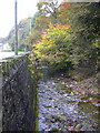
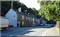
2
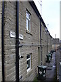
Back Alley between Woodcroft Street and Thorn Street
Back Alley leading of the A682, Burnley Road
Image: © Chris Heaton
Taken: 20 Apr 2022
0.02 miles
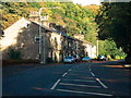
8
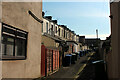
East Street
Note the hand rails on this steep street and check your hand-brake
Image: © Robert Wade
Taken: 19 Oct 2009
0.06 miles
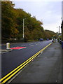
10
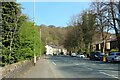
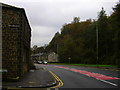
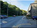
Burnley Road heading North out of Rawtenstall
The A682 road heading for Burnley
Image: © Chris Heaton
Taken: 20 Apr 2022
0.07 miles