IMAGES TAKEN NEAR TO
Taylor Street, ROSSENDALE, BB4 8HB
Introduction
This page details the photographs taken nearby to Taylor Street, BB4 8HB by members of the Geograph project.
The Geograph project started in 2005 with the aim of publishing, organising and preserving representative images for every square kilometre of Great Britain, Ireland and the Isle of Man.

There are currently over 7.5m images from over14,400 individuals and you can help contribute to the project by visiting https://www.geograph.org.uk
Image Map
Images are licensed for reuse under creativecommons.org/licenses/by-sa/2.0
Notes
- Clicking on the map will re-center to the selected point.
- The higher the marker number, the further away the image location is from the centre of the postcode.
Image Listing (135 Images Found)
Images are licensed for reuse under creativecommons.org/licenses/by-sa/2.0
Image
Details
Distance
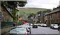
1
The White Lion, 72, Burnley Road, Rawtenstall
Image: © Alexander P Kapp
Taken: 7 Feb 2008
0.02 miles
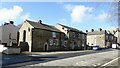
3
Kids Club, 1-3 Greenfield Street, Rawtenstall, Rossendale BB4 8JW
This used to be Greenfield Street WM Club. Now converted.
Image: © Robert Wade
Taken: 26 Jul 2007
0.03 miles
4
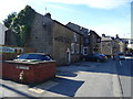
The White Lion, Rawtenstall
On Burnley Road.
Image: © JThomas
Taken: 25 Sep 2018
0.04 miles
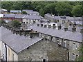
9
Ash Grove, Rawtenstall
Cul de Sac off Burnley Road in Rawtenstall
Image: © Chris Heaton
Taken: 20 Apr 2022
0.04 miles