IMAGES TAKEN NEAR TO
Bentwood Road, ROSSENDALE, BB4 5HH
Introduction
This page details the photographs taken nearby to Bentwood Road, BB4 5HH by members of the Geograph project.
The Geograph project started in 2005 with the aim of publishing, organising and preserving representative images for every square kilometre of Great Britain, Ireland and the Isle of Man.

There are currently over 7.5m images from over14,400 individuals and you can help contribute to the project by visiting https://www.geograph.org.uk
Image Map
Images are licensed for reuse under creativecommons.org/licenses/by-sa/2.0
Notes
- Clicking on the map will re-center to the selected point.
- The higher the marker number, the further away the image location is from the centre of the postcode.
Image Listing (118 Images Found)
Images are licensed for reuse under creativecommons.org/licenses/by-sa/2.0
Image
Details
Distance
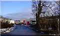
1
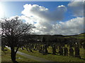
Churchyard of St James, Haslingden
Taken at the Church Street entrance, this is the churchyard of St James, Haslingden, Rossendale, Lancashire, and I am looking across the adjacent school towards Musbury Heights.
Image: © Carroll Pierce
Taken: 9 Feb 2018
0.03 miles
3
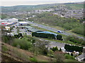
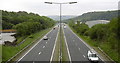
Haslingden Bypass
Looking north to the A56 Haslingden bypass follows the old track bed of the Ramsbottom to Accrington branch line that closed in 1966.
See also Image
The church in the picture is Image
Image: © Paul Anderson
Taken: 19 Apr 2007
0.09 miles
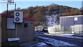
4
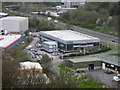
Hurstwood Group Head Office
Adjacent to the A56 Haslingden bypass is the head office of the Hurstwood Group a major employer of the area.
The company has become almost unrecognisable from the Rossendale based residential developer of 30 years ago. These days the group consists of 20 companies with gross assets of over £175 million and whilst still based in Haslingden, Hurstwood now operates nationwide and has regional offices in the North and Midlands see http://www.hurstwoodgroup.com/
Image: © Paul Anderson
Taken: 19 Apr 2007
0.10 miles
9
Haslingden Bypass A56
At this point it is following the line of the disused Accrington to Ramsbottom railway.
Image: © Robert Wade
Taken: 7 Jun 2007
0.11 miles
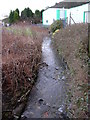
10
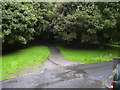
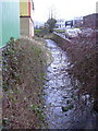
Lane off South Shore Street
This lane leads to the Lincoln Place area.
Image: © Robert Wade
Taken: 18 Aug 2008
0.12 miles