
IMAGES TAKEN NEAR TO
Helmshore Road, ROSSENDALE, BB4 4LQ
Introduction
This page details the photographs taken nearby to Helmshore Road, BB4 4LQ by members of the Geograph project.
The Geograph project started in 2005 with the aim of publishing, organising and preserving representative images for every square kilometre of Great Britain, Ireland and the Isle of Man.

There are currently over 7.5m images from over14,400 individuals and you can help contribute to the project by visiting https://www.geograph.org.uk
Image Map
Images are licensed for reuse under creativecommons.org/licenses/by-sa/2.0
Notes
- Clicking on the map will re-center to the selected point.
- The higher the marker number, the further away the image location is from the centre of the postcode.
Image Listing (172 Images Found)
Images are licensed for reuse under creativecommons.org/licenses/by-sa/2.0
Image
Details
Distance
1
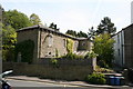
Helmshore: The 'Station Master's House'
It's difficult to know which grid square to put this in - the east-west grid line seems to go right through the middle of it. I doubt if it ever was the station master's house - Helmshore station, and the small three-road goods yard, were on the other side of Helmshore Road.
Image: © Dr Neil Clifton
Taken: 4 May 2011
0.01 miles
2
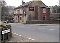
The Bridge End
On Helmshore Road, Helmshore.
Image: © Phil Platt
Taken: 29 Mar 2011
0.01 miles
3
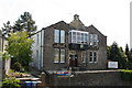
Helmshore: Sunny Bank Social Club
On the east side of Helmshore Road, (B6214).
Image: © Dr Neil Clifton
Taken: 4 May 2011
0.02 miles
4
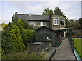
Sunnybank Club, Helmshore Road
This was built as The Liberal Club.
Image: © Robert Wade
Taken: 9 Oct 2008
0.02 miles
6
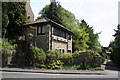
Helmshore: The 'Signal Box'
Well, it looks a bit like a signal box, and it's on the line of the old railway, BUT... (1)The old L&Y would never have built its signal boxes to such a high standard - they were mostly draughty wooden affairs on a brick base, and (2)I don't think there ever was a signal box in that exact location, although I will stand to be corrected on that one.
Image: © Dr Neil Clifton
Taken: 4 May 2011
0.02 miles
8
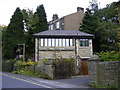
The Old Signal Box
The railway from Accrington to Ramsbottom crossed Helmshore Road at the point.
Image: © Robert Wade
Taken: 9 Oct 2008
0.03 miles
9
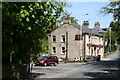
Helmshore: The 'Bridge End'
On Helmshore Road, (B6214).
Image: © Dr Neil Clifton
Taken: 4 May 2011
0.03 miles
10
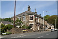
Helmshore: The 'Station'
There has been no station, or even a railway, in Helmshore since 1966, but the memory lingers on in the name of this pub. Ironically there is now a desire to provide railway facilities again to places such as Haslingen, Helmshore etc - rather difficult, as they covered much of the railway trackbed with a dual-carriageway road.
The spire of St. Thomas's Church can be seen in the background.
Image: © Dr Neil Clifton
Taken: 4 May 2011
0.03 miles