IMAGES TAKEN NEAR TO
Helmshore Road, ROSSENDALE, BB4 4AE
Introduction
This page details the photographs taken nearby to Helmshore Road, BB4 4AE by members of the Geograph project.
The Geograph project started in 2005 with the aim of publishing, organising and preserving representative images for every square kilometre of Great Britain, Ireland and the Isle of Man.

There are currently over 7.5m images from over14,400 individuals and you can help contribute to the project by visiting https://www.geograph.org.uk
Image Map
Images are licensed for reuse under creativecommons.org/licenses/by-sa/2.0
Notes
- Clicking on the map will re-center to the selected point.
- The higher the marker number, the further away the image location is from the centre of the postcode.
Image Listing (11 Images Found)
Images are licensed for reuse under creativecommons.org/licenses/by-sa/2.0
Image
Details
Distance
1
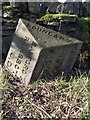
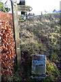
Old Boundary Marker by the B6214, Helmshore Road, Haslingden parish
Parish Boundary Marker by the B6214, in parish of Haslingden (Rossendale District), opposite Broadacres (Kenyon Clough House), West side of road.
Surveyed
Milestone Society National ID: LA_BYBB05pb
Image: © Milestone Society
Taken: Unknown
0.04 miles
3
Looking north from Kenyon Clough
A winter morning looking towards the village of Helmshore. Hill to the left is above Haslingden Grane, and to the right is the hill that splits Haslingden from Rawtenstall.
Image: © Dave Haygarth
Taken: 23 Dec 2005
0.11 miles
4
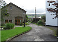
Track to Irwell Vale
Heading east from Holcombe Road. This track is un-named on the maps I've seen. It is signed as a footpath at the western end and is shown as such on the OS maps. However it is un-signed at the eastern end (Irwell Vale).
Image: © michael ely
Taken: 7 Sep 2008
0.21 miles
8
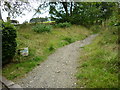
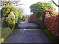
Moor Road at Dowry Head
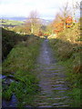
This is the beginning of the old Moor Road at Dowry Head, Helmshore, Lancashire.
Image: © Carroll Pierce
Taken: 27 Aug 2014
0.22 miles
9
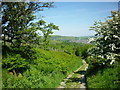
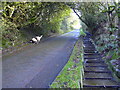
Moor Road, Helmshore
Taken at the top of the paved section of the Moor Road from Dowry Head and Helmshore, I am on my way up to Holcombe Moor, Lancashire.
Image: © Carroll Pierce
Taken: 11 Jun 2015
0.22 miles