
IMAGES TAKEN NEAR TO
Bank Fold Lane, DARWEN, BB3 3QG
Introduction
This page details the photographs taken nearby to Bank Fold Lane, BB3 3QG by members of the Geograph project.
The Geograph project started in 2005 with the aim of publishing, organising and preserving representative images for every square kilometre of Great Britain, Ireland and the Isle of Man.

There are currently over 7.5m images from over14,400 individuals and you can help contribute to the project by visiting https://www.geograph.org.uk
Image Map
Images are licensed for reuse under creativecommons.org/licenses/by-sa/2.0
Notes
- Clicking on the map will re-center to the selected point.
- The higher the marker number, the further away the image location is from the centre of the postcode.
Image Listing (10 Images Found)
Images are licensed for reuse under creativecommons.org/licenses/by-sa/2.0
Image
Details
Distance
1
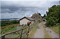
A smallholding at the bottom end of Bank Fold
Bank Fold consists mostly of former farming buildings which have been converted into nice residences.
Image: © Bill Boaden
Taken: 3 Jul 2010
0.12 miles
2
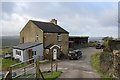
Holme Fold Farm
Small farm located high above the valley of Waterside Brook
Image: © Chris Heaton
Taken: 23 Dec 2019
0.14 miles
3
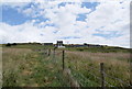
Hillside farm
The gradient here is steeper than it looks.
Image: © Bill Boaden
Taken: 3 Jul 2010
0.16 miles
4
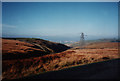
Hillside view
Travelling to Belthorn saw this view and captured it.Feb 1995
Image: © R lee
Taken: 24 Feb 1995
0.18 miles
5
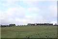
Crossing an Upland Pasture to Belthorn
A very faint path crosses diagonal over this pasture towards Belthorn on the skyline
Image: © Chris Heaton
Taken: 23 Dec 2019
0.19 miles
6
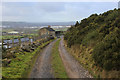
Access Track leading towards Holme Fold Farm
Image: © Chris Heaton
Taken: 23 Dec 2019
0.19 miles
7
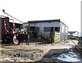
Tractor, calf and two sheep
In a yard off Belthorn Road.
Image: © philandju
Taken: 3 Mar 2014
0.20 miles
8
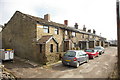
Tower View, Belthorn
Their view? is looking across the valley to Darwen Tower
Image: © Alexander P Kapp
Taken: 23 Mar 2006
0.23 miles
9
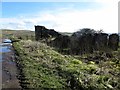
Derelict barn in Belthorn
On Tower View - a track so named because the Jubilee Tower at Darwen is visible on the skyline across the valley.
Image: © philandju
Taken: 3 Mar 2014
0.23 miles
10
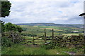
Footpath leaving Belthorn
This shows the view from Belthorn, and hence why so many houses on this side of Belthorn Road have 'View' or 'Prospect' in their names. The path leads down to Bank Fold.
Image: © Bill Boaden
Taken: 3 Jul 2010
0.25 miles