IMAGES TAKEN NEAR TO
Ash Grove, DARWEN, BB3 3AH
Introduction
This page details the photographs taken nearby to Ash Grove, BB3 3AH by members of the Geograph project.
The Geograph project started in 2005 with the aim of publishing, organising and preserving representative images for every square kilometre of Great Britain, Ireland and the Isle of Man.

There are currently over 7.5m images from over14,400 individuals and you can help contribute to the project by visiting https://www.geograph.org.uk
Image Map
Images are licensed for reuse under creativecommons.org/licenses/by-sa/2.0
Notes
- Clicking on the map will re-center to the selected point.
- The higher the marker number, the further away the image location is from the centre of the postcode.
Image Listing (10 Images Found)
Images are licensed for reuse under creativecommons.org/licenses/by-sa/2.0
Image
Details
Distance
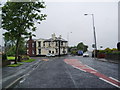
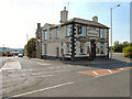
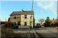
1
Former Oddfellows' Arms now called the Office
Image: © Alexander P Kapp
Taken: 9 Jul 2008
0.14 miles
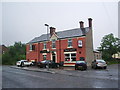
3
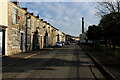
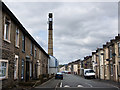
Olive Lane, Darwen
Residential thoroughfare in the old Lancashire town of Darwen
Image: © Chris Heaton
Taken: 15 Jan 2022
0.19 miles
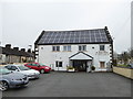
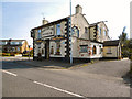
7
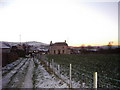
Punch Bowl Inn, Pothouse, Darwen
In the background is Darwen Jubilee Tower, erected 1897 to celebrate Queen Victoria's Diamond Jubilee AND the freeing of Darwen Moor
Image: © Eileen Cowen
Taken: 1 Apr 2003
0.22 miles