
IMAGES TAKEN NEAR TO
Proctor Fold, Osbaldeston Lane, BLACKBURN, BB2 7LU
Introduction
This page details the photographs taken nearby to Proctor Fold, Osbaldeston Lane, BB2 7LU by members of the Geograph project.
The Geograph project started in 2005 with the aim of publishing, organising and preserving representative images for every square kilometre of Great Britain, Ireland and the Isle of Man.

There are currently over 7.5m images from over14,400 individuals and you can help contribute to the project by visiting https://www.geograph.org.uk
Image Map
Images are licensed for reuse under creativecommons.org/licenses/by-sa/2.0
Notes
- Clicking on the map will re-center to the selected point.
- The higher the marker number, the further away the image location is from the centre of the postcode.
Image Listing (19 Images Found)
Images are licensed for reuse under creativecommons.org/licenses/by-sa/2.0
Image
Details
Distance
1
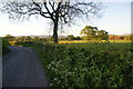
Osbaldeston Lane
Crossing lush Ribble Valley farmland between Osbaldeston and Osbaldeston Green. You can see Pendle far to the right.
Image: © Bill Boaden
Taken: 26 May 2012
0.05 miles
2
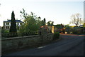
House for sale in Osbaldeston
There are several houses of at least this size along Osbaldeston Lane.
Image: © Bill Boaden
Taken: 26 May 2012
0.05 miles
3
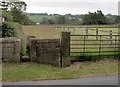
Footpath to Longsight road
The entrance to the footpath at the junction with Osbaldeston Lane leading to the A59 Longsight road.
Image: © Steve Houldsworth
Taken: 25 Jun 2010
0.07 miles
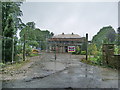
5
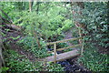
Footbridge over Mellor Brook
The path is little used, but at least the presence of a footbridge suggests you are on a proper path.
Image: © Bill Boaden
Taken: 26 May 2012
0.09 miles
7
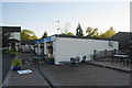
Where the footpath from Osbaldeston reaches the A59
I emerged by the factory unit on the right, though I should have come through the garden of the house on the left. It wasn't very clear from the other way.
Image: © Bill Boaden
Taken: 26 May 2012
0.13 miles
9
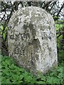
Old Boundary Marker by the A59, Longsight Road, Clayton le Dale
Parish Boundary Marker by the A59, in parish of Clayton Le Dale (Ribble Valley District), Longsight Road, 170m West of Fairfield Farm, on verge, Southeast side of road.
Inscription reads:-
: CLAYTON / LE / DALE : : MELLOR :
Surveyed
Milestone Society National ID: LA_CLAMEL01pb
Image: © Milestone Society
Taken: Unknown
0.14 miles
10
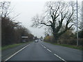
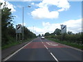
A59 nears Clayton-le-Dale village boundary
Image: © Colin Pyle
Taken: 15 Nov 2014
0.14 miles