IMAGES TAKEN NEAR TO
Osbaldeston Lane, BLACKBURN, BB2 7LT
Introduction
This page details the photographs taken nearby to Osbaldeston Lane, BB2 7LT by members of the Geograph project.
The Geograph project started in 2005 with the aim of publishing, organising and preserving representative images for every square kilometre of Great Britain, Ireland and the Isle of Man.

There are currently over 7.5m images from over14,400 individuals and you can help contribute to the project by visiting https://www.geograph.org.uk
Image Map
Images are licensed for reuse under creativecommons.org/licenses/by-sa/2.0
Notes
- Clicking on the map will re-center to the selected point.
- The higher the marker number, the further away the image location is from the centre of the postcode.
Image Listing (26 Images Found)
Images are licensed for reuse under creativecommons.org/licenses/by-sa/2.0
Image
Details
Distance
3
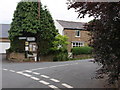
Junction Osbaldeston Lane & Higher Commons Lane
The junction of Osbaldeston Lane and Higher Commons Lane, the Osbaldeston Parish Council notice board can be seen under the street sign. Sign posted to the left Balderstone and to the right Osbaldeston Green Cul-De-Sac.
Image: © Steve Houldsworth
Taken: 25 Jun 2010
0.08 miles
4
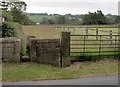
Footpath to Longsight road
The entrance to the footpath at the junction with Osbaldeston Lane leading to the A59 Longsight road.
Image: © Steve Houldsworth
Taken: 25 Jun 2010
0.10 miles
5
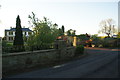
House for sale in Osbaldeston
There are several houses of at least this size along Osbaldeston Lane.
Image: © Bill Boaden
Taken: 26 May 2012
0.14 miles
7

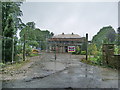
Flush Bracket G3387
Flush Bracket G3387 is on the road side of St Mary's RC Church in Osbaldeston. It is often hidden behind vegetation later in the year.
This flush bracket was used during the Third geodetic levelling, England & Wales. It was included on the Skipton to Hoghton levelling line.
Image: © Rude Health
Taken: 22 Feb 2014
0.15 miles
8

St Mary, Osbaldeston
The present mission is an offshoot from Samlesbury, and was founded in 1834 by the Rev. F. Curtis. Mass was said occasionally in an old farm-house, which served as school and chapel. In 1836, that great benefactor of Catholic parishes, Captain Heatley of Brindle Lodge, bought a farm of 49 acres as endowment and a piece of land of 3 acres for the church, presbytery and graveyard. With the donations of the generous Founder and with help from the voluntary labours of some of the men, a beautiful church and house were built in a solid and simple style well suited to the countryside. The church was opened on October 25, 1838.
Image: © Rude Health
Taken: 22 Feb 2014
0.16 miles
9

St. Mary's, Osbaldeston
Roman Catholic parish church
Image: © philandju
Taken: 29 Apr 2014
0.16 miles