
IMAGES TAKEN NEAR TO
Preston New Road, BLACKBURN, BB2 7AA
Introduction
This page details the photographs taken nearby to Preston New Road, BB2 7AA by members of the Geograph project.
The Geograph project started in 2005 with the aim of publishing, organising and preserving representative images for every square kilometre of Great Britain, Ireland and the Isle of Man.

There are currently over 7.5m images from over14,400 individuals and you can help contribute to the project by visiting https://www.geograph.org.uk
Image Map
Images are licensed for reuse under creativecommons.org/licenses/by-sa/2.0
Notes
- Clicking on the map will re-center to the selected point.
- The higher the marker number, the further away the image location is from the centre of the postcode.
Image Listing (31 Images Found)
Images are licensed for reuse under creativecommons.org/licenses/by-sa/2.0
Image
Details
Distance
2

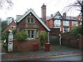
Island of greenery outside Tauheedul Islam Girls' High School
This signage is at the drop-off point at the front of Tauheedul Islam Girls' High School.
Image: © Greum
Taken: 4 Jun 2023
0.03 miles
3

Roomali at The Woodlands
The Woodlands is a former hostelry now home to Roomali Blackburn, an Indian restaurant.
Image: © Greum
Taken: 4 Jun 2023
0.05 miles
4
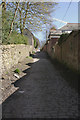
Scarr Lane
There are a lot of unadopted roads in Blackburn, many of them still showing the original cobbles. This was taken looking up towards Revidge road.
Image: © Mr T
Taken: 4 Apr 2007
0.05 miles
5

Scar Lane
The western section of Scar Lane heads downhill from Preston New Road between Beardwood Hospital and Tauheedul Islam Girls' High School.
Image: © Greum
Taken: 4 Jun 2023
0.07 miles

7
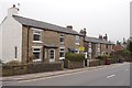
Revidge Road, Blackburn
The two bedroomed house was priced at about £78,000.
Image: © Richard Webb
Taken: 4 Apr 2019
0.10 miles
8

Billinge End
Looking down Preston New Road (on the left) towards Blackburn town centre at the junction with Billinge End Road (foreground) and Revidge Road.
Image: © Greum
Taken: 4 Jun 2023
0.10 miles
9
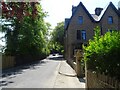
Cambay Villas and Billinge End Road
The start of the climb along Billinge End Road, with Cambay Villas, an imposing Victorian edifice, on the right of the shot.
Image: © Greum
Taken: 4 Jun 2023
0.11 miles
10
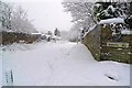
White road
Wycollar Road doing its best to usurp the real White Road. Anybody tempted to get the sledge out and belt down here would need to dig their heels in deep at the bottom to stop before meeting the traffic crawling along Preston New Road.
Image: © Mr T
Taken: 5 Jan 2010
0.11 miles