
IMAGES TAKEN NEAR TO
Pleasington Lane, BLACKBURN, BB2 6RF
Introduction
This page details the photographs taken nearby to Pleasington Lane, BB2 6RF by members of the Geograph project.
The Geograph project started in 2005 with the aim of publishing, organising and preserving representative images for every square kilometre of Great Britain, Ireland and the Isle of Man.

There are currently over 7.5m images from over14,400 individuals and you can help contribute to the project by visiting https://www.geograph.org.uk
Image Map
Images are licensed for reuse under creativecommons.org/licenses/by-sa/2.0
Notes
- Clicking on the map will re-center to the selected point.
- The higher the marker number, the further away the image location is from the centre of the postcode.
Image Listing (46 Images Found)
Images are licensed for reuse under creativecommons.org/licenses/by-sa/2.0
Image
Details
Distance
1

Victoria Road, Pleasington
Looking south on National Cycle Route 6.
Image: © JThomas
Taken: 25 Oct 2018
0.01 miles
2

Pleasington Priory
The path to the west front of Pleasington Priory.
Pleasington Priory, or the Church of St Mary and St John Baptist, has been designated by English Heritage as a Grade I listed building. It was built between 1816 and 1819.
Image: © David Dixon
Taken: 23 Aug 2012
0.02 miles
3

Gateway to Pleasington Priory
The R.C. church is dedicated to Ss. Mary and John the Baptist. It is within the parish of St. Oscar Romero in the Diocese of Salford.
Image: © philandju
Taken: 25 Aug 2022
0.02 miles
4

Car park entrance
The church car park in Pleasington is off Priory Close.
Image: © philandju
Taken: 25 Aug 2022
0.02 miles
5

Pleasington Priory churchyard
Looking north from the church door.
Image: © philandju
Taken: 25 Aug 2022
0.02 miles
6

Pleasington Priory (the Church of St Mary and St John Baptist)
Pleasington Priory, or the Church of St Mary and St John Baptist, has been designated by English Heritage as a Grade I listed building. It was built between 1816 and 1819.
Image: © David Dixon
Taken: 23 Aug 2012
0.03 miles
7

Pleasington Priory
The nineteenth century Pleasington Priory (the Roman Catholic Church of St Mary and St John Baptist) viewed from the other side of Victoria Road.
Image: © David Dixon
Taken: 23 Aug 2012
0.03 miles
8

The West Doorway, Pleasington Priory
Pleasington Priory, or the Church of St Mary and St John Baptist, has been designated by English Heritage as a Grade I listed building. It was built between 1816 and 1819.
Image: © David Dixon
Taken: 23 Aug 2012
0.03 miles

10
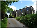
Sweet Within and School House
Now two houses, this building began life as a single cottage called Sweet Within before serving as the local school back in Victorian times. It lies on the corner of Old Hall Lane and Victoria Road/Sandy Lane just north of Pleasington Priory.
Image: © Greum
Taken: 7 Jun 2023
0.03 miles