
IMAGES TAKEN NEAR TO
Honeysuckle Gardens, BLACKBURN, BB2 5DA
Introduction
This page details the photographs taken nearby to Honeysuckle Gardens, BB2 5DA by members of the Geograph project.
The Geograph project started in 2005 with the aim of publishing, organising and preserving representative images for every square kilometre of Great Britain, Ireland and the Isle of Man.

There are currently over 7.5m images from over14,400 individuals and you can help contribute to the project by visiting https://www.geograph.org.uk
Image Map
Images are licensed for reuse under creativecommons.org/licenses/by-sa/2.0
Notes
- Clicking on the map will re-center to the selected point.
- The higher the marker number, the further away the image location is from the centre of the postcode.
Image Listing (6 Images Found)
Images are licensed for reuse under creativecommons.org/licenses/by-sa/2.0
Image
Details
Distance
1
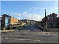
Moorland Drive, Green Hills, Livesey
Looking up Moorland Drive, entrance to the recently-built Green Hills estate.
Image: © Greum
Taken: 25 Sep 2021
0.17 miles
2
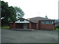
Catholic Church of St John Vianney, Blackburn
Image: © Alexander P Kapp
Taken: 20 Jul 2006
0.19 miles
3
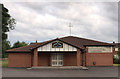
St John Vianney, Livesey
The Roman Catholic Church Livesey Branch Road near the junction with Gibb Lane Blackburn. Founded before 1962 it was still in use when this image was taken.
Image: © Steve Houldsworth
Taken: Unknown
0.20 miles
6
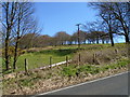
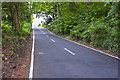
Bunker's Hill Wood
Looking up towards Bunker's Hill Wood through a break in the trees by the side of Gib Lane.
Image: © Greum
Taken: 18 Apr 2015
0.22 miles