
IMAGES TAKEN NEAR TO
Plantation Road, BLACKBURN, BB2 4QA
Introduction
This page details the photographs taken nearby to Plantation Road, BB2 4QA by members of the Geograph project.
The Geograph project started in 2005 with the aim of publishing, organising and preserving representative images for every square kilometre of Great Britain, Ireland and the Isle of Man.

There are currently over 7.5m images from over14,400 individuals and you can help contribute to the project by visiting https://www.geograph.org.uk
Image Map
Images are licensed for reuse under creativecommons.org/licenses/by-sa/2.0
Notes
- Clicking on the map will re-center to the selected point.
- The higher the marker number, the further away the image location is from the centre of the postcode.
Image Listing (7 Images Found)
Images are licensed for reuse under creativecommons.org/licenses/by-sa/2.0
Image
Details
Distance
1
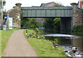
Canada Geese on the towpath of the Leeds and Liverpool Canal
Next to Kings Bridge No 96A in Blackburn.
Image: © Mat Fascione
Taken: 16 Jul 2016
0.16 miles
2
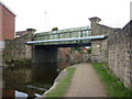
Leeds and Liverpool Canal Bridge #96A
Kings Bridge Street
Image: © Ian S
Taken: 19 Mar 2011
0.16 miles
3
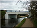
Leeds and Liverpool Canal Bridge #96B
Moorgate Street
Image: © Ian S
Taken: 19 Mar 2011
0.17 miles
4
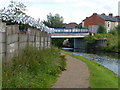
Moorgate Fold Bridge No 96B
Crossing the Leeds and Liverpool Canal in Blackburn.
Image: © Mat Fascione
Taken: 16 Jul 2016
0.17 miles
5
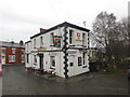
The Navigation public house at Mill Hill
Image: © John Slater
Taken: 6 Dec 2014
0.18 miles
6
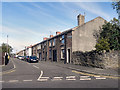
Anglesey Street
Anglesey Street, from Shorrock Lane.
Image: © David Dixon
Taken: 23 Jul 2011
0.21 miles
7
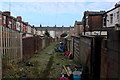
Alleyway behind Angela Street, Blackburn
In the Mill Hill area of Blackburn, as seen from the towpath of the Leeds and Liverpool Canal.
The fly tipping along here looks so bad, it must warrant as a health hazard.
Image: © Chris Heaton
Taken: 8 Jan 2020
0.22 miles