IMAGES TAKEN NEAR TO
Pleasant View, BLACKBURN, BB2 3HF
Introduction
This page details the photographs taken nearby to Pleasant View, BB2 3HF by members of the Geograph project.
The Geograph project started in 2005 with the aim of publishing, organising and preserving representative images for every square kilometre of Great Britain, Ireland and the Isle of Man.

There are currently over 7.5m images from over14,400 individuals and you can help contribute to the project by visiting https://www.geograph.org.uk
Image Map
Images are licensed for reuse under creativecommons.org/licenses/by-sa/2.0
Notes
- Clicking on the map will re-center to the selected point.
- The higher the marker number, the further away the image location is from the centre of the postcode.
Image Listing (20 Images Found)
Images are licensed for reuse under creativecommons.org/licenses/by-sa/2.0
Image
Details
Distance
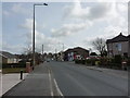
1
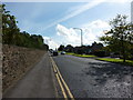
Old Bank Lane
Old Bank Lane, at its junction with Roman Road/Brandy House Brow.
Image: © David Dixon
Taken: 20 Jul 2011
0.05 miles
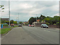
2
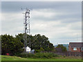
Mobile Phone Mast Behind Roman Road
Mobile phone mast in the south east corner of Image]
Image: © David Dixon
Taken: 20 Jul 2011
0.08 miles
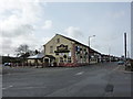
4
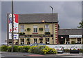
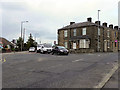
Another View of The Observatory
KFC on the right
Image: © Robert Wade
Taken: 24 Jun 2007
0.10 miles
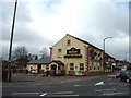
8
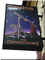
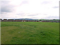
I see no ship
The Observatory, Old Bank Lane, Blackburn, Sign
Image: © Alexander P Kapp
Taken: 19 Mar 2010
0.11 miles
9
The Observatory, Old Bank Lane, Blackburn
Image: © Alexander P Kapp
Taken: 19 Mar 2010
0.12 miles