
IMAGES TAKEN NEAR TO
Avon Close, BLACKBURN, BB2 2ND
Introduction
This page details the photographs taken nearby to Avon Close, BB2 2ND by members of the Geograph project.
The Geograph project started in 2005 with the aim of publishing, organising and preserving representative images for every square kilometre of Great Britain, Ireland and the Isle of Man.

There are currently over 7.5m images from over14,400 individuals and you can help contribute to the project by visiting https://www.geograph.org.uk
Image Map
Images are licensed for reuse under creativecommons.org/licenses/by-sa/2.0
Notes
- Clicking on the map will re-center to the selected point.
- The higher the marker number, the further away the image location is from the centre of the postcode.
Image Listing (50 Images Found)
Images are licensed for reuse under creativecommons.org/licenses/by-sa/2.0
Image
Details
Distance
1
New train maintenance depot at Blackburn
The King Street branch once led to the coal sidings in the area known as The Wrangling. After being disused for many years the alignment was re-used for Northern Rail's new maintenance depot opened in November 2017. It is intended to service new Class 195 trains (not yet introduced), but in the short term to cover for the temporary loss of the maintenance facility at Blackpool during the 2018 blockade of the Blackpool North line. [source: https://www.railengineer.uk/2017/11/07/constructing-blackburns-new-train-depot/ ]
Image: © Stephen Craven
Taken: 24 Mar 2018
0.06 miles
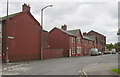
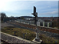
3
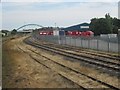
Bolton Road railway junction
Rounding the curve from the Bolton direction, the train will shortly be passing under the Freckleton Road bridge and arriving at Blackburn station.
When the line from Bolton was opened in 1848 by the Bolton, Blackburn, Clitheroe & West Yorkshire Railway, they had to build their own station at Darwen Street, immediately beyond the Freckleton Road bridge. It wasn't until 1859 that these trains could use the current Blackburn station.
Image: © Nigel Thompson
Taken: 26 Jul 2014
0.09 miles
4
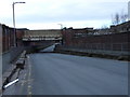
Railway bridge-Galligreaves St
Road under bridge which used to carry lines to coal sidings near to King St.
Image: © Tony Mercer
Taken: 1 Feb 2009
0.09 miles
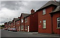
6
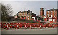
Blackburn Fire Station (Byrom street)
Built in the early twentieth century. The roadworks in the foreground are part of the building of a new bridge over the railway.
Image: © Mr T
Taken: 13 Apr 2007
0.13 miles
7
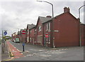
Canterbury Street-Harrison Street, Blackburn
Image: © Robert Wade
Taken: 1 Aug 2010
0.13 miles
8
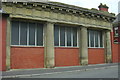
Blackburn Fire Station, Lancashire
Sumner Street side
Image: © Robert Wade
Taken: 1 Aug 2010
0.13 miles
9
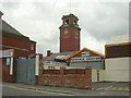
Blackburn Fire Station Tower, Lancashire
Image: © Robert Wade
Taken: 1 Aug 2010
0.13 miles
10
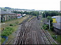
Bolton Road Junction
The three tracks going to the right is the Blackburn to Preston Line, the single track to the left is the Clitheroe to Manchester Line
Image: © Alexander P Kapp
Taken: 23 Jun 2008
0.14 miles