IMAGES TAKEN NEAR TO
Longroyd Road, BARNOLDSWICK, BB18 6NZ
Introduction
This page details the photographs taken nearby to Longroyd Road, BB18 6NZ by members of the Geograph project.
The Geograph project started in 2005 with the aim of publishing, organising and preserving representative images for every square kilometre of Great Britain, Ireland and the Isle of Man.

There are currently over 7.5m images from over14,400 individuals and you can help contribute to the project by visiting https://www.geograph.org.uk
Image Map
Images are licensed for reuse under creativecommons.org/licenses/by-sa/2.0
Notes
- Clicking on the map will re-center to the selected point.
- The higher the marker number, the further away the image location is from the centre of the postcode.
Image Listing (32 Images Found)
Images are licensed for reuse under creativecommons.org/licenses/by-sa/2.0
Image
Details
Distance
1
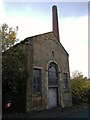
Brook Mills Engine House & Chimney
One of the few survivors of Earby's industrial past. The mill it was attached to has been completely demolished, and now only the footprint of the building remains.
Image: © Matthew Hatton
Taken: 20 Oct 2018
0.10 miles
2

Ordnance Survey Cut Mark
This OS cut mark can be found on the north parapet of the bridge over New Cut. It marks a point 134.109m above mean sea level.
Image: © Adrian Dust
Taken: 19 Jun 2021
0.10 miles
3
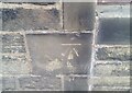
Ordnance Survey Cut Mark
This OS cut mark can be found on No16 Rostle Top Road. It marks a point 139.437m above mean sea level.
Image: © Adrian Dust
Taken: 19 Jun 2021
0.16 miles
5
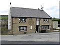
The 'White Lion', Earby
There are two 'Lions' in Earby, one white and one red. It is not far to walk between them, so both can be sampled on one visit. Both offer food and excellent beer.
Image: © Dr Neil Clifton
Taken: 26 May 2008
0.17 miles
7
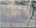
Ordnance Survey Cut Mark
This OS cut mark can be found on the wall west side of Colne Road. It marks a point 133.685m above mean sea level.
Image: © Adrian Dust
Taken: 19 Jun 2021
0.20 miles