IMAGES TAKEN NEAR TO
Hill Street, BARNOLDSWICK, BB18 6FB
Introduction
This page details the photographs taken nearby to Hill Street, BB18 6FB by members of the Geograph project.
The Geograph project started in 2005 with the aim of publishing, organising and preserving representative images for every square kilometre of Great Britain, Ireland and the Isle of Man.

There are currently over 7.5m images from over14,400 individuals and you can help contribute to the project by visiting https://www.geograph.org.uk
Image Map
Images are licensed for reuse under creativecommons.org/licenses/by-sa/2.0
Notes
- Clicking on the map will re-center to the selected point.
- The higher the marker number, the further away the image location is from the centre of the postcode.
Image Listing (333 Images Found)
Images are licensed for reuse under creativecommons.org/licenses/by-sa/2.0
Image
Details
Distance


4

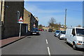
Electricity Substation No 2576 - Bank Street
Image: © Betty Longbottom
Taken: 30 Jul 2016
0.03 miles
6

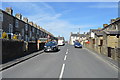
Wellhouse Square, Barnoldswick
The small town of Barnoldswick has street after street of modest terraced houses, no doubt originally built for mill workers. Some of the terraces are unusual in that they face on to pedestrian walkways with access lanes to the rear.
Image: © Gordon Hatton
Taken: 5 Apr 2018
0.05 miles

8
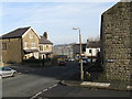
Wellhouse Road, Barnoldswick
At the bottom of Wellhouse Road, it bends round sharply to meet Valley Road.
Image: © Dr Neil Clifton
Taken: 9 Feb 2008
0.05 miles