
IMAGES TAKEN NEAR TO
Weets View, BARNOLDSWICK, BB18 6EF
Introduction
This page details the photographs taken nearby to Weets View, BB18 6EF by members of the Geograph project.
The Geograph project started in 2005 with the aim of publishing, organising and preserving representative images for every square kilometre of Great Britain, Ireland and the Isle of Man.

There are currently over 7.5m images from over14,400 individuals and you can help contribute to the project by visiting https://www.geograph.org.uk
Image Map
Images are licensed for reuse under creativecommons.org/licenses/by-sa/2.0
Notes
- Clicking on the map will re-center to the selected point.
- The higher the marker number, the further away the image location is from the centre of the postcode.
Image Listing (109 Images Found)
Images are licensed for reuse under creativecommons.org/licenses/by-sa/2.0
Image
Details
Distance
1
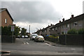
Barnoldswick: Weets View
These houses were originally built for the former West Riding County Council.
Image: © Dr Neil Clifton
Taken: 2 Aug 2011
0.01 miles
2
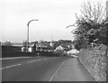
Skipton Road, Barnoldswick
Looking east from the top of the canal bridge. Brown's Garage is seen on the right in the distance - advertising four-star petrol at 43.5 pence per litre.
Image: © Dr Neil Clifton
Taken: 12 May 1990
0.01 miles
3
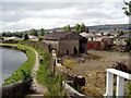
Coates Wharf, Leeds and Liverpool Canal, Barnoldswick
The derelict Coates Wharf as seen from the top of Bridge 154A.
Image: © Dr Neil Clifton
Taken: 20 Aug 2005
0.03 miles
5
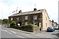
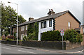
Barnoldswick: Roundell Terrace, Skipton Road
Image: © Dr Neil Clifton
Taken: 2 Aug 2011
0.05 miles
6
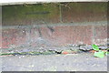
Benchmark on #11 Coates Avenue
Ordnance Survey cut mark benchmark described on the Bench Mark Database at http://www.bench-marks.org.uk/bm69896
Image: © Roger Templeman
Taken: 22 Aug 2015
0.05 miles
7
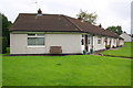
Bungalows on Coates Avenue
There is an OS benchmark Image on the bricks below the pebbledash on the NW corner of the nearest house
Image: © Roger Templeman
Taken: 22 Aug 2015
0.05 miles
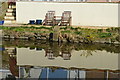
10
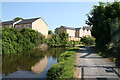
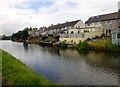
Leeds and Liverpool Canal: North of Bridge 154A
New houses have been built here on the site of a former print works. We are looking south here towards Bridge 154A, which is, however, not in view.
Image: © Dr Neil Clifton
Taken: 5 Jun 2016
0.05 miles