
IMAGES TAKEN NEAR TO
Earby Road, BARNOLDSWICK, BB18 5TH
Introduction
This page details the photographs taken nearby to Earby Road, BB18 5TH by members of the Geograph project.
The Geograph project started in 2005 with the aim of publishing, organising and preserving representative images for every square kilometre of Great Britain, Ireland and the Isle of Man.

There are currently over 7.5m images from over14,400 individuals and you can help contribute to the project by visiting https://www.geograph.org.uk
Image Map
Images are licensed for reuse under creativecommons.org/licenses/by-sa/2.0
Notes
- Clicking on the map will re-center to the selected point.
- The higher the marker number, the further away the image location is from the centre of the postcode.
Image Listing (6 Images Found)
Images are licensed for reuse under creativecommons.org/licenses/by-sa/2.0
Image
Details
Distance
2
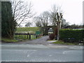
Railway bridge, Salterforth, Yorkshire
This bridge formerly carried the Barnoldswick branch of the Midland Railway, which fell victim to the Beeching axe in the 1960s. The cart road ahead leads to Kelbrook; to the left is Earby, and to the right the main part of Salterforth village.
Image: © Dr Neil Clifton
Taken: 13 Mar 2006
0.17 miles
4
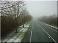
Kelbrook Road
Taken from the Skipton-bound 872 bus as it travels towards Salterforth and Barnoldswick on the B6383, the Kelbrook Road.
Image: © Carroll Pierce
Taken: 18 Jan 2015
0.20 miles
5
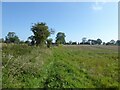
Field path off Earby Road
Heading towards the Pennine Bridleway on Mucky Lane
Image: © Kevin Waterhouse
Taken: 6 Sep 2024
0.24 miles
6
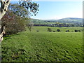
The Pennine Bridleway near Spen Head Farm
Image: © Dave Kelly
Taken: 23 Oct 2019
0.25 miles