
IMAGES TAKEN NEAR TO
Fernbank Avenue, BARNOLDSWICK, BB18 5JW
Introduction
This page details the photographs taken nearby to Fernbank Avenue, BB18 5JW by members of the Geograph project.
The Geograph project started in 2005 with the aim of publishing, organising and preserving representative images for every square kilometre of Great Britain, Ireland and the Isle of Man.

There are currently over 7.5m images from over14,400 individuals and you can help contribute to the project by visiting https://www.geograph.org.uk
Image Map
Images are licensed for reuse under creativecommons.org/licenses/by-sa/2.0
Notes
- Clicking on the map will re-center to the selected point.
- The higher the marker number, the further away the image location is from the centre of the postcode.
Image Listing (138 Images Found)
Images are licensed for reuse under creativecommons.org/licenses/by-sa/2.0
Image
Details
Distance
1
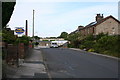
Fern Bank Avenue, Barnoldswick, Yorkshire
Fern Bank Avenue is a road off the west side of Gisburn Road. Its original purpose was to serve Fern Bank Mill, where it ended. This is taken from the junction of Fern Bank Avenue with Coniston Avenue, looking towards the mill, which is now closed and mostly demolished, although the chimney remains as seen here.
Image: © Dr Neil Clifton
Taken: 8 Jul 2007
0.01 miles
2
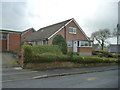
Barnoldswick: 1 Fernbank Avenue
Side view from Coniston Avenue
Image: © Dr Neil Clifton
Taken: 13 Mar 2017
0.03 miles
3
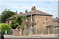
Barnoldswick: Oakfield Avenue
There are just five houses in this terrace off the north side of Fernbank Avenue, numbered 2-10 from the end nearest the camera. Vehicular access is to the rear only. There are no odd-numbered houses.
Image: © Dr Neil Clifton
Taken: 16 Jul 2017
0.04 miles
4
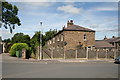
Barnoldswick: Oakfield Avenue
This also shows the beginning of the path, with public right of way, which runs past the fronts of the houses, then across Aynham's fields to reach Brogden Lane. See also Image
Image: © Dr Neil Clifton
Taken: 16 Jul 2017
0.04 miles
5
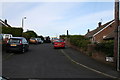
Ambleside Avenue, Barnoldswick, Yorkshire
Ambleside Avenue is a cul-de-sac off the west side of Coniston Avenue. Most of its houses are post-WWII bungalows in the private sector.
Image: © Dr Neil Clifton
Taken: 8 Jul 2007
0.05 miles
6
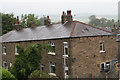
Barnoldswick: Oakfield Avenue
This small terrace of houses is off Fernbank Avenue. The houses have no vehicular access to their front doors, but they do have such access at the rear.
Image: © Dr Neil Clifton
Taken: 15 Jul 2017
0.05 miles
7
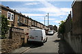
Barnoldswick: Rosemount Avenue
Looking now south from Fernbank Avenue, this shows the backs of odd numbered houses 37 to 1, on the left. The house backs on the right belong to 1 to 15, Coniston Avenue. At the far end, this path meets the 'Catwalk', rising from Gidburn Road. The house seen right at the far end is 34, Frederick Street.
Image: © Dr Neil Clifton
Taken: 16 Jul 2017
0.05 miles
8
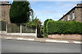
Barnoldswick: Rosemount Avenue
This shows the footpath which runs along Rosemount Avenue, north of Fernbank Avenue.
Image: © Dr Neil Clifton
Taken: 16 Jul 2017
0.05 miles
9
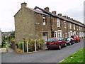
Terrace housing, Frederick Street, Barnoldswick, Yorkshire
Image: © Dr Neil Clifton
Taken: 12 Jul 2004
0.05 miles
10
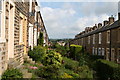
Rosemount Avenue, Barnoldswick
When Rosemount Avenue was originally built, off Fern Bank Avenue, it was like any other street, with a vehicular way in front of the houses, albeit in this case unmetalled. However in the early 1970s the opportunity was taken to turn the whole street into gardens, as seen here, just leaving a pedestrian way between them. The disadvantage, of course, is that the houses only have car access at the back. The same happened to Melville Avenue, a parallel road to the east.
Image: © Dr Neil Clifton
Taken: 8 Jul 2007
0.05 miles