
IMAGES TAKEN NEAR TO
York Fields, BARNOLDSWICK, BB18 5DA
Introduction
This page details the photographs taken nearby to York Fields, BB18 5DA by members of the Geograph project.
The Geograph project started in 2005 with the aim of publishing, organising and preserving representative images for every square kilometre of Great Britain, Ireland and the Isle of Man.

There are currently over 7.5m images from over14,400 individuals and you can help contribute to the project by visiting https://www.geograph.org.uk
Image Map
Images are licensed for reuse under creativecommons.org/licenses/by-sa/2.0
Notes
- Clicking on the map will re-center to the selected point.
- The higher the marker number, the further away the image location is from the centre of the postcode.
Image Listing (74 Images Found)
Images are licensed for reuse under creativecommons.org/licenses/by-sa/2.0
Image
Details
Distance
1
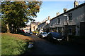
Myers Street, Barnoldswick, Yorkshire
This shows the pleasant environment of these cottages which are 16 to 2 Myers Street. At the lower end it forms a junction with Park Avenue. At the upper end, it joins York Fields, but a row of posts prevents vehicles from driving through.
Image: © Dr Neil Clifton
Taken: 30 Oct 2007
0.07 miles
2
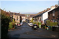
York Street (upper portion), Barnoldswick
York Street is quite a long street, as can be seen in the picture. This is the portion above Park Avenue, with even numbers from 86 downwards.
Image: © Dr Neil Clifton
Taken: 30 Oct 2007
0.08 miles
4
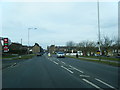
Park Avenue, Barnoldswick
Looking north-east from the junction with Cobden Street
Image: © Dr Neil Clifton
Taken: 30 Oct 2007
0.12 miles
5
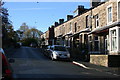
Park Avenue, Barnoldswick
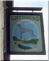
Looking westwards from the junction with York Street, this shows houses numbered 14 and upwards. At the far end of Park Avenue is a T-junction with Manchester Road by the 'Greyhound' public house.
Image: © Dr Neil Clifton
Taken: 30 Oct 2007
0.12 miles
6
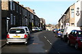
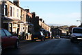
York Street, (middle portion), Barnoldswick
Taken from the junction with Park Avenue, this shows on the right, houses from 58 downwards (even numbers).
Image: © Dr Neil Clifton
Taken: 30 Oct 2007
0.12 miles
8
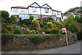
'Alma Cliffe', Manchester Road
There is an OS benchmark Image on a large stone left of the 'for sale' sign
Image: © Roger Templeman
Taken: 29 Aug 2015
0.13 miles
9
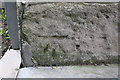
Benchmark on 'The Greyhound' pub
Ordnance Survey cut mark benchmark described on the Bench Mark Database at http://www.bench-marks.org.uk/bm46655
Image: © Roger Templeman
Taken: 29 Aug 2015
0.13 miles
10
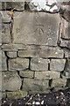
Benchmark on Manchester Road wall
Ordnance survey cut mark benchmark outside 'Alma Cliffe', described on the Bench Mark Database at http://www.bench-marks.org.uk/bm47576
Image: © Roger Templeman
Taken: 29 Aug 2015
0.13 miles