1
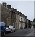
York Street (upper portion), Barnoldswick
York Street is quite a long street, as can be seen in the picture. This is the portion above Park Avenue, with even numbers from 86 downwards.
Image: © Dr Neil Clifton
Taken: 30 Oct 2007
0.04 miles
2
York Street, (middle portion), Barnoldswick
Taken from the junction with Park Avenue, this shows on the right, houses from 58 downwards (even numbers).
Image: © Dr Neil Clifton
Taken: 30 Oct 2007
0.07 miles
3
Park Avenue, Barnoldswick
Looking westwards from the junction with York Street, this shows houses numbered 14 and upwards. At the far end of Park Avenue is a T-junction with Manchester Road by the 'Greyhound' public house.
Image: © Dr Neil Clifton
Taken: 30 Oct 2007
0.07 miles
4
Benchmark on #50 Essex Street
Ordnance Survey cut mark benchmark described on the Bench Mark Database at http://www.bench-marks.org.uk/bm46651
Image: © Roger Templeman
Taken: 29 Aug 2015
0.07 miles
5
Row of houses on Essex Street
There is an OS benchmark
Image on the front corner of the nearest house on the side road face
Image: © Roger Templeman
Taken: 29 Aug 2015
0.08 miles
6
Myers Street, Barnoldswick, Yorkshire
This shows the pleasant environment of these cottages which are 16 to 2 Myers Street. At the lower end it forms a junction with Park Avenue. At the upper end, it joins York Fields, but a row of posts prevents vehicles from driving through.
Image: © Dr Neil Clifton
Taken: 30 Oct 2007
0.08 miles
7
Mosley Street, Barnoldswick
A typical street of terraced houses to the south of the town centre.
Image: © Bill Harrison
Taken: 24 Aug 2018
0.08 miles
8
Essex Street, Barnoldswick
Looking south east on the B6383.
Image: © JThomas
Taken: 2 Aug 2018
0.08 miles
9
Kelbrook Road
Image: © Colin Pyle
Taken: 16 Feb 2013
0.09 miles
10
Essex Street in Barnoldswick
Image: © Steve Daniels
Taken: 19 Jun 2015
0.09 miles


