
IMAGES TAKEN NEAR TO
Lee Lane, BLACKBURN, BB1 4AJ
Introduction
This page details the photographs taken nearby to Lee Lane, BB1 4AJ by members of the Geograph project.
The Geograph project started in 2005 with the aim of publishing, organising and preserving representative images for every square kilometre of Great Britain, Ireland and the Isle of Man.

There are currently over 7.5m images from over14,400 individuals and you can help contribute to the project by visiting https://www.geograph.org.uk
Image Map
Images are licensed for reuse under creativecommons.org/licenses/by-sa/2.0
Notes
- Clicking on the map will re-center to the selected point.
- The higher the marker number, the further away the image location is from the centre of the postcode.
Image Listing (7 Images Found)
Images are licensed for reuse under creativecommons.org/licenses/by-sa/2.0
Image
Details
Distance
1

Lee Valley golf range
Next to former farm of Tottleworth Lee whose macaws sound louder than the ring of driver on ball.
Image: © Mike and Kirsty Grundy
Taken: 6 Aug 2005
0.06 miles
2

Bus stop on Lee Lane (B6535)
Towards Great Harwood.
Image: © JThomas
Taken: 19 Apr 2019
0.06 miles
3

Is this where they grow the golf balls?
Tottleworth Lee golf driving range
Image: © Ian Greig
Taken: 19 Feb 2016
0.08 miles

5
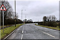
Lee Lane
The B6535 between Great Harwood and Rishton.
Image: © David Dixon
Taken: 12 Mar 2018
0.16 miles
6

Pathway by Lee Lane
Pavement next to the B6535 Rishton/Great Harwood Road.
Image: © Chris Heaton
Taken: 27 Apr 2014
0.20 miles
7

Leeds and Liverpool Canal
Looking west from Tottleworth Bridge
Image: © Alexander P Kapp
Taken: 15 Feb 2010
0.25 miles