
IMAGES TAKEN NEAR TO
Walker Industrial Park, Walker Road, BLACKBURN, BB1 2LJ
Introduction
This page details the photographs taken nearby to Walker Industrial Park, Walker Road, BB1 2LJ by members of the Geograph project.
The Geograph project started in 2005 with the aim of publishing, organising and preserving representative images for every square kilometre of Great Britain, Ireland and the Isle of Man.

There are currently over 7.5m images from over14,400 individuals and you can help contribute to the project by visiting https://www.geograph.org.uk
Image Map
Images are licensed for reuse under creativecommons.org/licenses/by-sa/2.0
Notes
- Clicking on the map will re-center to the selected point.
- The higher the marker number, the further away the image location is from the centre of the postcode.
Image Listing (6 Images Found)
Images are licensed for reuse under creativecommons.org/licenses/by-sa/2.0
Image
Details
Distance
1
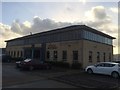
Clayton House
The Diocese of Blackburn's new diocesan offices in the Walker Office Park.
Image: © John H Darch
Taken: 21 Dec 2015
0.18 miles
2
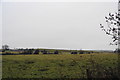
Fields up to Fishmoor Reservoir
The dam wall is clear at the top of the hill. To the right is the JJB Soccerdome, as still commonly referred to, though I think it is now called the DW Sports Fitness Centre.
Image: © Bill Boaden
Taken: 12 Jan 2011
0.20 miles
3
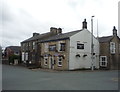
The Blackamoor Inn
On Roman Road.
The PC brigade don't appear to arrived here yet.
Image: © JThomas
Taken: 10 Sep 2018
0.22 miles
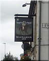
5
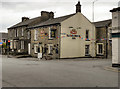
Blackamoor Inn, Roman Road
The Blackamoor Inn, at the corner of Roman Road and Stopes Brow (Image])
Image: © David Dixon
Taken: 20 Jul 2011
0.22 miles
6

Crossroads on Roman Road
A busy junction, and the fast phasing of the traffic lights causes queues for those trying to cross between Blackamoor Road and Stopes Brow.
Image: © Bill Boaden
Taken: 12 Jan 2011
0.24 miles