IMAGES TAKEN NEAR TO
Barrowford Road, BURNLEY, BB12 9AS
Introduction
This page details the photographs taken nearby to Barrowford Road, BB12 9AS by members of the Geograph project.
The Geograph project started in 2005 with the aim of publishing, organising and preserving representative images for every square kilometre of Great Britain, Ireland and the Isle of Man.

There are currently over 7.5m images from over14,400 individuals and you can help contribute to the project by visiting https://www.geograph.org.uk
Image Map
Images are licensed for reuse under creativecommons.org/licenses/by-sa/2.0
Notes
- Clicking on the map will re-center to the selected point.
- The higher the marker number, the further away the image location is from the centre of the postcode.
Image Listing (4 Images Found)
Images are licensed for reuse under creativecommons.org/licenses/by-sa/2.0
Image
Details
Distance
1
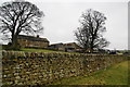
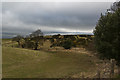
Copthurst Farm
This suffered from the lack of any footpath signs around it.
Image: © Bill Boaden
Taken: 19 Feb 2011
0.02 miles
2
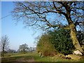
Farm Track
The track between Old Jeremy's farm and Holly Hill which is a public right of way
Image: © John Sparshatt
Taken: 28 Mar 2012
0.23 miles
3
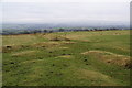
The remains of field boundaries
Several fields have merged to form a large area for grazing sheep. Two footpaths cross at this point but they are undefined.
Image: © Bill Boaden
Taken: 19 Feb 2011
0.24 miles